TheGlobe-Trotters

TheGlobe-Trotters

Friday, February 27, 2015

Kapingamarangi

Map picture


My guess is that you have never heard that name before. You might be surprised to know that for one thing it is the name of an atoll. You might also be interested to learn that it is connected to The United States by way of a Compact of Free Association. With that opener, let me see if I can elaborate.

If you have heard the word “atoll,” but do not really know the meaning, then join the club, because neither did I until last evening when I asked the question during our briefing as to what exactly is an “atoll?” First and foremost an “atoll” is a ring-shaped coral reef which at its center a lagoon of water. This ring of coral is the remains of an extinct volcano which has been eroded over time such that the coral has built a reef around the old volcano’s rim. The center of this ring is where the old caldera of the volcano has eroded below sea level and is now filled with seawater encircled by the coral reef. Around the coral rim, there can be small islands or cays, some large enough to be inhabited. The atoll of Kapingamarangi encompasses 74 square km in total area. However, out of this, there is only 1.1 square km of land which is then spread over 33 wooded cays. Today we visited the small island of Touhou and walked over a bridge to its neighbor of Welua Island.

Because of the ring of coral and the depth of the surrounding waters, our ship could not anchor, but did manage to float just outside the coral boundary. Our ride into the village was an exciting one because there is only one way through the coral ring and into the lagoon, and it is a curving channel with strong currents at times. In addition, the village was over five miles from our ship so the ride ashore took almost 30 minutes, and when I looked back I could barely see our floating “home.”

This has to be one of the most isolated places I have ever visited. It is over 300km to its closest neighbors, and the island receives supplies only three times a year, yet it is home to around 400 people. There were no welcoming ceremonies this time just people who had a big smile, and were glad to give us free rein to tour their village. DSC03093At the time we visited the island, I was not aware of the connection to the U.S., so I was a little surprised that everyone spoke good English. After returning the ship and doing a little research, I found that 89% of the population over the age of 15 can read and write English. The village was clean, and people were more than glad to stop what they were doing to talk. One gentleman explained to me how he was making a new roof for his home. He was taking dry palm leaves and tying them to a pole about 4 feet long. When he had produced enough of these, he told me that it only took one day for he and his neighbors to replace both the roof and sides of his home, but it will take him 4 months to produce enough material. DSC03113I saw that the island had pipes that delivered fresh water to homes, and I even caught sight of an electrical cord, but I never saw any electrical appliances. Lisa and I walked across a long bridge connecting the two main islands and had intended to visit the school on the adjacent island, but good old Jimbob took a wrong turn, and we never found the school. DSC03117One quick look at our watches told us it was time to return to the dock for our long ride back to the ship. In fact, when our little zodiac exited the reef, our ship was still a long ways off. To our delight, seeing our predicament, the Captain told us to stay put and he would bring the ship to us. I had my camera in a waterproof bag otherwise I would very much have liked to get a picture of the big ship bearing down on our little boats.

Everyone returned to the ship for lunch, and in the afternoon we were offered a chance to return to the lagoon and visit an uninhabited cay where we could go snorkeling. Lisa and I really planned on doing this, but for some reason we were so exhausted from the morning that we both had a quick bite to eat and promptly fell asleep. So much for being big adventures!!

I do need to finish my opening comments regarding the connection to the United States. Where we went today was our first stop in the Federated States of Micronesia. Kapingamarangi Atoll is part of the Caroline Islands and at the very southern end of the island chain. Within the Caroline chain there are five main island groups, and four of those now comprise the Federated States of Micronesia. The fifth and westernmost island group became the country of Palau. All of the islands became a UN Trust Territory under US administration following World War II. Independence came in 1986, along with a Compact of Free Association with the US. This Association was amended and renewed in 2004, and under the terms of that agreement the United States will provide roughly $2.1 billion in grants to the FSM, which includes the creation of a Trust Fund to provide an income stream after the agreement expires.

Every day Lisa and I are blessed to see What a Wonderful World we live in and I never cease to be amazed at the many things I am still learning about our planet. I hope everyone is enjoying our travels.

Jim

PS I forgot to mention that last night we crossed the equator.

Wednesday, February 25, 2015

PNG

Map picture

Can you name the country represented by those letters? Let me give you a few clues: It occupies the eastern half of the second largest island in the world. It is part of the Oceania group of islands, and is home to over six million people. The official language is Tok Pisin, and while English is also an official language, less than 2% of the population uses it. Indeed because the country is mostly mountainous terrain, it is home to communities which have been separated for centuries, and as a result over 860 native languages have been identified. It is also home to one of the world’s largest swamps. I might also throw into the mix, the fact that the country is situated along the Pacific “Ring Of Fire” and as such, is subject to frequent and sometimes severe earthquakes, mud slides and tsunamis, and volcanic eruptions. So, what do you think?

I have been describing the country of Papua New Guinea our most recent stop on this exciting voyage. Our ship arrived into the port city of Rabaul around 5pm. During the arrival, the decks were filled with people taking photographs of the Rabaul Volcano which destroyed the city in 1937, and again in 1994. It was for this reason, that the Capital of the country was moved from Rabaul to Kokopo, after the last eruption left the city mostly in ruins. The volcano is an impressive sight which is surrounded by less active volcanos in an arc of activity. DSC02555The Rabaul volcano is still active to this day, and plumes of smoke were clearly visible spewing from its top.

Dinner was served very early in order that all of us could participate in an evening outing into the Baining Mountains to witness a performance of the famous Baining Fire Dance. This amazing spectacle is performed by the Baining People to commemorate important events within their community such as a birth, a good harvest, a death or the transition into manhood. In the past, this was a men’s event only, and women and children were forbidden to be present. The elaborate masks and costumes are worn for a one-time use only, and are supposed to be destroyed after each ceremony. If truth be told, the evening’s event was a performance that had been arranged on our behalf, so all around the chairs which had been setup for our use; there was a large crowd of onlookers including women and children. This is not to say that this tradition is dead. Indeed we later learned that a small child who was sick was carried by one of the dancers in the hope that the evil spirit causing his illness might be banished.

I have gotten slightly ahead of myself since first I must share our ride into the mountains. We were advised against going outside the security perimeter after dark on our own. My personal experience was that people all along the way seemed friendly all the while waving and smiling as we passed, and yet after we departed the pier, we entered a world without much if any light, and groups of young teens, who lined the dark, would find our watches or cameras irresistible in a country in which the average yearly income is only $2,800. Our drive took almost an hour along roads which at times were paved (complete with potholes here and there) or just plain dirt roads with muddy patches. There were no street lamps and the only light to pierce the darkness were small LED’s or fluorescent lamps which radiated through the thick jungle or lit the many roadside stalls around which people congregated. What truly amazed me was the sheer number of people walking along the roads in the pitch dark. The roads were narrow, and most of these people were dressed in dark clothes, not to mention that they were also dark skinned. Our caravan of vans moved along the roads at what seemed like a breakneck speed with our headlamps on low; people along the roads appeared literally out of nowhere, sometimes just a single person, sometimes entire families with children who were actually in the road itself. That alone was bad enough, but the roads were at time winding sharply and coming around a sharp curve sometimes a person would just jump with surprise. How we managed to miss hitting someone was a mystery to me.

We finally arrived all in one piece at the open area where the night’s performance was to take place. Chairs had been setup for our use, and as soon as we were seated, our vans withdrew and along with them their headlights. We were left in total darkness, and as our eyes adjusted, we realized that above us was a beautiful almost cloudless night with a half moon and canopy of brilliant stars. As is typical of “island time,” the musicians had not yet arrived, and so one of our staff scientists gave a presentation on the ancient way of the Micronesian navigators. He, himself, is a member of the Polynesian Voyaging Society whose members navigate their huge canoes around the Pacific using only these ancient techniques. His impromptu presentation about the various constellations was fascinating, and I was sorry to see him stop when the locals were ready to begin.

In front of us a fire had been glowing, but now young men started to build the fire into a roaring inferno. They kept this up for the next hour during the performance. I suddenly became aware that all around us locals had arrived and were quietly standing or sitting all around behind us. Then I became dimly aware of shadowy figures lurking just outside the light of the fire. The musicians started to play a rhythmic beat as elaborately adorned figures appeared in the light. As they danced, mostly in the shadows, one of their members from time to time would run up to and kick the roaring fire which then sent the fire even higher. DSC02887Eventually dancers appeared to run through the fire which then sent sparks heavenward in an awesome display in which the burning embers seemed to float up to the stars above.

Now imagine how as photographers both Lisa and I were dying to capture images of what we were seeing. Think of the challenges: if we used a flash, we ruined the moment and got a photograph without real meaning. On the other hand, we were trying to take a photograph in total darkness except for the roaring fire of men who were on the move and dancing at times quite rapidly. For the entire hour both Lisa and I tried every trick we had and between us probably took over 1,000 pictures. In the end, I think I got a few that are worthy to share, but sadly no video – I just could not get it to work in the dark.

So we returned back to the ship around 10pm, hot and tired, only to be greeted on the pier by a large group of the ship’s crew holding a large sign, “WELCOME HOME.” In addition, the Hotel Department had prepared a late evening snack with live music and plenty of “refreshment.” What a wonderful and appreciated surprise.

Before our ship departed at noon the following day, we were treated to a morning tour of the Rabaul area and the nearby town of Kokopo. Truthfully, I was not overly impressed by what I saw. Papua New Guinea is still a pretty developing country. We first drove to the Volcano Observatory where there is an active monitoring of the nearby volcanos. The facility was not very modern or impressive. They had recently replaced their old thermal drum monitors with computerized displays, but funding only allows them to actually monitor 3 or 4 volcanos. I could not understand all that the resident technician said, but I did catch the question about whether or not if a volcano was about to erupt, did they have a red light or something to warn them so the locals could be warned. Sadly the technician noted, that feature broke some time back, and they do not have the funds to replace it – end of story.

Our next stop was to a WW II museum, which contained mostly old Japanese war equipment. This is logical since Japan occupied Papua New Guinea during the war and it was a major supply base. Just down the road, we stopped to view a long tunnel which had been built by the Japanese using POW’s and slave labor. Inside this tunnel were the rusting hulks of self-propelled supply barges which were used to offload supply ships and to then hide them from Allied Forces. There were one or two other stops including the local market and then it was time to say goodbye and sail on to our next stop, the small island of Tatau, Papua New Guinea.

Sadly our stop at Tatau had to be cancelled due to the rough seas. One thing the ship cannot control is the weather; so we have a day at sea as we make our way northwestward to our next scheduled stop at Kapingamarangi, Pohnpei, Federated States of Micronesia.

So go look that destination up in your “Funk and Wagnell!”

Jim

Monday, February 23, 2015

Island Weary

Map picture
I am embarrassed that my last communication was five days ago. In all honesty, these cruises are packed full of activities, and I am almost at the point of thinking “another day, ah, another island.” After a while, they all start to run together, and Lisa and I are running low on our energy levels.

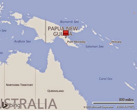
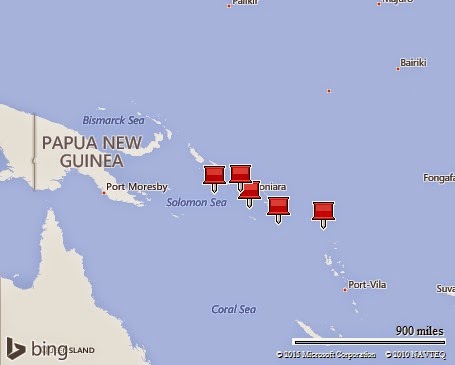
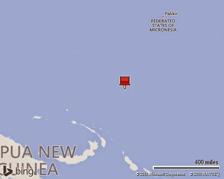
So, with this update, I will see if I can make things right by getting you caught up on what has been happening since my last blog about the Tikopia Islands on Febuary 18th. Since then, the ship has made stops at the Islands of , Santa Ana, Guadalcanal, Lumalihe, and lastly the tiny island of Njari. All of these islands are part of the Solomans, and today, February 23rd, is our last day in the Solomons as we have just raised the anchor and are headed to Papua New Guinea.

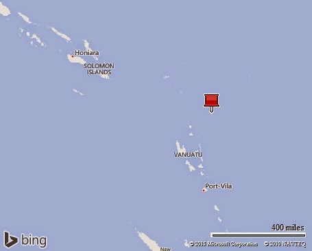
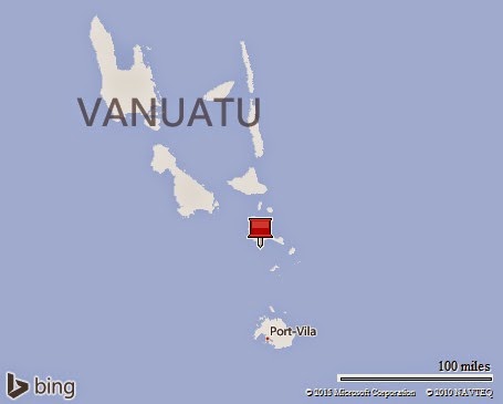
Thursday February 19th Utupua Island:

We were given a warm and tumultuous greeting to the island of Utupua. I say warm because the local villagers were on the beach in large numbers to welcome us to their village, Nembao. It is the main village on the 26 square mile island, and the locals were clearly glad to see us. I also said that our welcome was “tumultuous” because as each zodiac approached the beach a large group of young males, dressed as warriors, came rushing from behind the bushes while brandishing wooden swords and yelling threateningly. Of course it was all in fun, and the minute the “performance” was over, the youngsters went off laughing and frolicking up the beach. At this point, we were at liberty to tour the village, which as we have seen previously, might have been primitive and the homes spartan, but it was as neat as possible. I did catch sight of photoelectric units mounted besides several huts, and I also saw a cell phone or two; the modern world is creeping slowly into even this remote village.

The time finally arrived for the welcoming ceremonies, and they were very elaborate and unlike anything we have seen previously. Setup in the center of the village was a circular compound which was fenced off by a bamboo fence. Extending from the center of the compound was a very long and elaborately adorned pole which was lying on the ground with one end located in the center of the compound and the other lying on the ground at some distance away. The end of the pole outside the compound was secured by very long vines which ran up into the trees. For the life of me I could not imagine what all this was about. With my bum knee, I was having trouble standing so long, and to my amazement one of the locals built a seat for me out of cinder blocks. I felt like a chief, and even offered to fulfill any wishes our crew might have – no one accepted my offer however. Soon the pace of things increased and young men started to climb up into the surrounding trees where they could grab the vines attached to the pole. Then in a flurry of activity which was coordinated by the chief, slowly, very slowly, the pole was raised upright in the center of the compound. For the life of me, I could not imagine the significance of the pole. It was elaborately adorned with what I would call, Christmas tree like ornaments hanging high above the ground on protrusions from the top. Soon I heard the singing and chanting of men and women alike who were dressed in leaves. They formed a line and danced into the compound where they circled the pole in a series of rhythmic and enchanting dances. Afterwards a group of young men dressed as traditional warriors, danced for us, and it was over.DSC02414 Later we learned that the elaborate dance we had witnessed had to do with a story related to a snake. The pole represented the snake and the long lines of the dancers as they moved in a snakelike fashion were likewise related to this story. When the greetings and gifts were exchanged, we took a zodiac ride along the fjord which ran deep into the island’s interior, however, when the heavy rains arrived, we headed to the ship, wet to the bone, but happy.

Friday February 20th Santa Ana Island:

Here we are in yet another island paradise complete with clear blue skies, white sandy beaches, and coral reefs seemingly everywhere you looked. Our ship anchored in the small bay in front of the main village of Ghupuna. Going ashore in a wet landing on a beautiful sandy beach, we were welcomed by locals and invited to tour the village at our leisure. Lisa and I headed in the general direction in which the welcome ceremonies would be conducted, but it was obvious that this was a rather large community and pretty well organized. Yes, the homes were built in the traditional manner made of local timber and leaf, and were built on stilts. What caught my eye immediately was the array of pipes which crisscrossed the village. I later learned that these pipes brought fresh water from a lake in the island’s center to each home.DSC02494 I also spotted solar panels outside almost every home which provided small amounts of electricity – at least enough to keep their cell phones charged.

The festivities were to take place in what appeared to be a soccer field, and they had set up plastic chairs for us in order to watch the shows. Unlike earlier islands where the greeting ceremonies had the feeling of authenticity, it appeared that in this village they were presenting a show just for us. Most of the locals ignored the presentation. We had two performances. The first was women singing and dancing, but the second was much more elaborating, colorful, and rather unique. But neither took very long, and it was time to head back to the ship since tomorrow marked the end of this cruise segment.

Thursday February 21th Guadacanal:

This stop was entirely different than any of our prior visits. For one thing, the ship actually was able to pull into a real port and tie up alongside a pier. We had reached the city of Honiara which is the largest city on the island of Guadalcanal. This was also a “turn around day” which means that with the end of one cruise, many guests will be departing the ship, and almost immediately another group will be boarding. In fact, only six of us were staying on for the next cruise which I believe will have around 65 guests.

It is not uncommon for the ships to ignore the guests like us who are “in transit,” however; Silversea was thoughtful enough to arrange a tour of the area for us. The city is home to the famous “Henderson Field” from World War II fame. Originally built by the Japanese, it was taken by US forces and became the focal point for major battles in 1942. Lisa and I both had read extensively about the battles on Guadalcanal; in fact, I had an Uncle who served in the marines here. Our van drove us to the site of some of the bloodiest battles of the war which was a solemn moment for us. I looked across those hills, and could still see where the marines had dug foxholes for themselves. At the top of Edson’s bloody ridge, a white monument had been erected in recognition of the battle, but it was sad to see that the monument had not only been defaced, but the brass plaque on the front had been removed. Shortly after we arrived, children from all around came running carrying artifacts from the war which they wanted to sell us – old canteens full of bullet holes, marine helmets, bullets, etc.; it was all very disappointing.

As we drove around the “city,” I was disappointed to see how dirty and poor it seemed. We visited the National Museum. The good thing is that it was actually air conditioned, while the sad news is that it was nothing; not well maintained, not much of a collection, and just plain boring. Lastly, we climbed atop Skyline Ridge, which offered good views of the city below, but more importantly, it was there that we found the US War Memorial which is maintained by a little known commission of the US government.P1000423 The Memorial was spotless and guarded at all times. Finally, we found a truly fitting memorial to what had happened on this island, and it made me proud that we were remembering those who sacrificed for our freedom. On our way back to the ship, we visited “Henderson Field. After about 4 hours we returned to our floating “home.” Well actually, we returned to a somewhat new home; for the first time we had to change rooms because we were not able to book the same room for the entire trip. Believe it or not we hardly had to lift a hand. Except for moving the contents of our safe before getting off the ship, our room steward took care of everything else. I’d say he had done this sort of thing before!

Thursday February 22th Lumalihe Island:

During our first cruise, there were several opportunities to snorkel, and both Lisa and I dutifully checked out our equipment. Only one little problem – well, make that two. I had not even been swimming for over a decade, let alone snorkel in deep water, and secondly, Lisa doesn’t know how to swim, although long ago she did some snorkeling with me. So on the few occasions when snorkeling was offered as part of the day, we both were tired by other activities, and trying snorkeling in the afternoon seemed just too much. In truth, I think we were both a little hesitant.

Now we come to Lumalihe Island which is located in Marovo Lagoon, one of the largest saltwater lagoons in the world. The American author James Michener described the lagoon as “one of the seven natural wonders of the world,” and the double barrier reef system of the lagoon is currently under consideration by UNESCO to be granted World Heritage Site status. If ever there was a location where snorkeling made sense, it was here.

In the morning, we made a quick visit to Lumalihe Island. Even though the island is not inhabited, word of our visit was common knowledge to the villages in the area, and people in large number came to the island in order to display and sell their carvings and crafts. In our honor, they also put on a brief performance. The first featured around 16 young boys led by an elder performing what I would call some basic cheerleading displays. Next was a group of women who sang a beautiful series of songs before the rains ran us and most of the crowd back to the ship.

I do have one cute story to share. One of the scientists, Malcom, is a biologist who delights in finding interesting things – plant or animal that we might not notice. And so as I came ashore I looked up and he had an animal that I did not immediately recognize, but was informed was a hermit crab.DSC02501 It was about the size of a small fist and was walking up his arm. He reached over and placed it on my arm whereupon it proceeded to walk up my arm towards my face. I asked Malcom if the little darling would bite, and he assured me that they were harmless, unless of course they felt threatened. Just before it reached my face, Malcom gently picked it up and turned it around so that it would go back down my arm, and this must have alarmed the little devil because he reached out with his big claw and gave me a right proper bite! So much for strange “cute” little creature--I think.

After a quick lunch back on the ship, I made the decision to try snorkeling. I was more than a little anxious, because even though I could swim, I was hosting both bum shoulders and an injured left leg. I first had to get down to the zodiac, which then took me to a zodiac pair. They were anchored over the snorkel site. I had to then transfer over to one of the pair, where I got left my reef runner shoes and got my face mask and flippers ready. Then I transferred to diving zodiac and after getting everything set, I nervously slid over the side into the warm water of the lagoon. Oh my – it was beautiful. In fact, it was more than beautiful, it was breathtaking. The sheer variety of fish and the vibrant colors were amazing. I told myself that I would stay in the water for only an hour, and when I looked at my watch the hour had passed. My biggest challenge was then to return to the zodiac. They had a ladder over the side which should have been fine, but between my injured left leg and my limited left arm, getting up turned into a real and embarrassing challenge. The crew was awesome and with their help, I finally made it, and I was really glad I had taken the plunge.

Thursday February 23th Njari Island, Solomons:

Finally I come to today at Njari Island. The ship has anchored off this Island for only one reason, and that is because it is a great dive and snorkel site. There will be no wet beach landing on the uninhabited island just an opportunity to enjoy a morning snorkeling. Two things are different about today vs. yesterday. First, and most importantly, Lisa decided to take the plunge and go snorkeling. The crew of the ship could not have done a better job of helping her, and immediately after getting in the water, the ship’s photographer stayed with her until she was sure that Lisa was fine by herself. The other thing that was different today is that I took an underwater camera with me. 100_0015Several years ago I bought a cheap little Kodak underwater camera for a trip that ended up being canceled. When I saw it in the cabinet at home I decided to bring it and today I got a chance to use it. I had to learn how to use it on the fly and so much of what I did get was not great, but if I get the opportunity again, I think I’ll do much better.

By 11am the ship lifted the anchor and we started on our trip northward which will see us leaving the Solomon Islands and docking tomorrow afternoon at the capital of Papua New Guinea, Rabaul.

I am sorry for this long update, and I really will try to stay more current as I move forward. I hear that weather in the Kansas City area is not good, and I would like to tell you that I feel guilty down here in the beautiful South Pacific – but in truth, I don’t.

Jim

Wednesday, February 18, 2015

Where On Earth Is: Tikopia?

Map picture

Where On Earth Is: Tikopia?

I have come to the conclusion that if I had started to travel sooner and only spent my time visiting Islands, that in a lifetime, it would not be possible to visit every inhabited Island on this planet, let alone the uninhabited ones. Our visit today to Tikopia is a good example.

This tiny island is but one of three islands which collectively are known as the Santa Cruz Islands. They are the southern border of the Solomon’s and are considered as part of the Solomon Chain, although much of the local culture is ruled by local Chiefs. The closest small island neighbor is 20 miles away. Tikopia itself is only 2 sq. miles in size, yet it is home to 1,200 people. Surprisingly, the population of this tiny island has remained fairly constant since the 1600’s because the island has strict reproductive policies to prevent a further increase since the Chief’s realize that is the maximum number of people which the island is capable of supporting. Even though the island is small, it is home to 20 villages mostly along the coast, and it is ruled by four chiefs who still hold courts in their huts. Unlike the Westernizing of societies which is taking place all around them, Tikopia society is little changed from ancient times. Unlike the islands we have recently visited, these people are Polynesian and not Melanesian.

Our first challenge today was to get ashore where the natives were lined up all along the beach to greet us. Unlike many Pacific islands where they are surrounded by calm lagoons with a volcanic core, Tikopia is an old volcanic island which has been uplifted, reef and all out of the ocean. So, in order to reach the beach, we had to cross a very long distance over the shallow reef. This is one reason that this island has remained so remote, because it is difficult to reach. When we arrived, the tide had gone out so even our shallow zodiacs were not able to approach the beach. We had to go out a very long way from shore, and walk over uneven coral beds with unseen holes. The islanders, male and female, had walked all the way to where we had come, and as I exited the zodiac an unknown islander took hold of my hand, and with his very strong hand, he literally walked me ashore. Once on shore, we were surrounded by welcoming faces. From our landing site, we had a long walk along the edge of the very neat village to their school where seats had been arranged for us. As we walked, every single one of us had at least one if not two children holding our hands along the way.

Arriving at the school and once things calmed down, a man came forward and spoke to the crowd. He started off by explaining that today was a very sad occasion for the islanders. The prior day, all of the Chiefs on the island, along with a number of islanders had departed the island. We never actually got an explanation as to whether or not this was permanent or temporary, but our host was apologizing for our not being given a proper greeting to the island. He seemed very embarrassed that we were being treated this way, but he wanted us to know how pleased the islanders were that we had come and they wanted to share some hospitality with us. With the Chief having departed, all services on the island had come to a stop, including their schools. However, in a departing gesture, the local chief had agreed to the use of the school today so that we might be entertained.

What followed was a very well done performance by the school children singing and from the older boys, a local dance. Again, our host came forward and bowed in apology for such a poor offering, but he wanted us to know how welcome we were and that we were free to roam the island at will including a walk to the center of the island where there was a large lake which had formed from an earlier volcano which had shrunk. About half of our group set off for the 4km roundtrip hike, while Lisa and I set about returning to the ship. Once again, I had a companion, and young boy of 11 whose name was Daniel.

Reaching our departure point, we could look across the brilliant white sand and blue skies, and truly think we had indeed found paradise. I might also add that in the 2 hours we had been on the island the tide had come in and they were able to get a zodiac up to the beach. If we kept it lightly loaded, then it would be possible to drive all the way out of the coral floor to reach the large breakers awaiting us when we reached the ocean. We carefully threaded our way across the reef until reaching the ocean where we encountered some large waves. By the time we reached our ship, everyone and everything on the little zodiac was completely soaked. But, hey this is an adventure after all.

Jim

Tuesday, February 17, 2015

Vanuatu: A Step Back In Time

Map picture

Vanuatu, formerly known as New Hebrides, achieved independence in 1980. The country is a chain of islands that run north to south in the South Pacific Ocean about three-quarters of the way from Hawaii to Australia. There are more than 80 islands in the chain, but only 65 are inhabited. All of the islands are volcanic in origin, and most of them still have volcanic activity, some even underwater. We are indeed right at the heart of the so called “ring of fire” which surrounds the Pacific Ocean.

Our first stop, of course, was to clear the ship with local officials. This can at times be a tedious affair, or it can be a matter of minutes. Well, in the case of Vanuatu it took days! At first there was the usual long line of officials, well actually there were only a few “actual” Officials, the rest of the entourage were relatives, friends and who knows what, but they all knew where to find a “good meal.” I guess some actual “official” work took place, but within minutes the breakfast area was besieged by locals. As is the custom in some parts of the world, before departing the ship, several of the dignitaries managed to receive “tokens of appreciation” meaning wine or alcohol. What was unusual was that three rather huge men remained onboard for our entire three days that we would be cruising in Vanuatu. It was hilarious, really! For example, our lunch room remains open for lunch between 12 and 2pm. To us that means that you can go for lunch anytime during those hours. The officials from Vanuatu appeared to think that meant to go to lunch at noon and to remain until 2, eating as much as possible in the interim. They ate so much food that I could not believe it. I can assure you that when we left they were a sad lot.

As you know I was grounded from going ashore on our first stop in Vanuatu, Tanna Island. During the morning, the ship stopped first at a small island near Tanna called Aniwa Island. Here people did some serious snorkeling on a shallow reef. Lisa and I stood on deck and waved them on. Moving the ship over lunch, we arrived at Tanna itself around 2pm. The first activity was to make a wet landing onto a black sandy beach, and from there to be transported by truck to the village of Port Resolution. First, however, we had to be greeted in the traditional manner. Now, I was really feeling much better, in part to all the pills the doctor had given me, but hey, I figured what he did not know would not hurt him, so Lisa and I went ashore to view the ceremony and visit the village.

It seemed that a large number of locals had come to welcome us to the island as well as to watch the festivities. They were gathered in large groups and were colorfully dressed. In several groups, they had bands playing; all in all, it was great fun. We were seated on coconut tree trunks and then officially welcomed by the chief. DSC02103There followed several colorful performances by both men and women after which we were transported to the village for a tour. Because of my back, the crew made sure that I was able to sit in a real seat while most everyone else was confined to sitting on boards across the rear of a pickup truck. We then set off on one of the god awful lest rides I have ever undergone. There were no “roads” only muddy dirt trails that twisted and turned at every tree and went up and down like a roller coaster. I had to hold on for dear life as our driver took the roads at mind numbing speed. We kept getting lost and backing up a great deal, before finally arriving at the village.

You know you can tell a great deal about a people by the way they live.DSC02114 These people might be living in relatively primitive conditions, but the village was neat as possible. The entire village had been raked clean, and all around villagers had setup stands and locations where they demonstrated how they functioned. We, of course, saw the school, but we also saw how they slaughtered and cleaned a hog. They showed us how to weave some really exotic bags and mats, and all of this was done with great pride. I just about fell off my log when my guide calmly pulled out a cell phone to answer a call! It appears that they have cell coverage all over the island, and they also have smart phones and access to the internet on their phones and in certain locations where they have electricity there are computers. After a fun visit, our group was scheduled to be transported up to the rim of the Volcano, and from there they could walk approximately 1,200 feet uphill on a very rough terrain so that they would be on top for sunset. The volcano on Tanna Island is continuously active, and is constantly throwing out a stream of molten lava which at night is spectacular. As much as I wanted to get those pictures, I was smart enough to realize that walk was way out of my ability right now with my bad back, and so Lisa and I returned to the ship where were could see the red glow coming from the top of the mountain.

The next day everyone on the ship was bone tired from two long days in a row so thankfully we had a morning to rest before reaching our next destination which was the island of Ambrym, Vanuatu. We made anchor around 3pm, and went ashore in the zodiacs to land on a beautiful black sand beach. The sand was black of course because the island itself was of volcanic origin, and in fact, it too had an active volcano at the center of the island. We came to this remote island at the invitation of the Great Chief to witness the rarely performed “Rom dance of Ambrym”. I will tell you that Lisa and I have been witness to many elaborate native dances, but this was without question the best we have ever seen. The dancers were all male and wore elaborate costumes. These very special coverings can only be worn once, and then must be destroyed. Before the dance may be done again, they must all be recreated. If you look at my pictures you can see that the male dancers leave nothing to the imagination. Their only attempt at modesty is to wear a cover on their penis. Of course the Chief must have the longest cover, and I can let you imagine how the rest go down in size. DSC02209The ceremony, which goes on for quite some time we later learned is actually preformed for the villagers once a year after harvest, and at that time the young boys of the village are circumcised. Thankfully we were spared that part of the ceremony. After the dancers were done, they came out for photographs and then everyone disappeared leaving the Chief and his assistant standing. We were told that we could approach no closer than 3 feet to the Chief, but that we could take photographs. To our surprise both Lisa and I were separately invited by the Chief to have our photographs taken with him – actually pretty amazing.

At this point, we were invited to walk along the beach to the Village. I asked our guide how long the walk would be and if using my walking stick I could make it. He thought for a moment and replied that it should normally be a 5 minute walk, but in my case perhaps 10 minutes. The ship was offering to move me down the beach in the zodiac, but since the surf was very high, I decided a 10 minute walk was better than fighting to get back into and out of the zodiac. WELL, if I could find the guy who told me 10 minutes I would give him a piece of my mind. The walk took over an HOUR. The ship assigned two crew members to help me through the mud and across the rocks. At one point, they literally had to carry me over a river. By the time I reached the Village, I had missed the tour and I immediately had to board the zodiac back to the ship. Yet another Grrrr!

Last night the crew through a huge party by the pool for the 32 of us. The Chef was happily squeezed into a corner grilling the biggest lobsters I have ever seen. They had a huge affair and we had music, drinks, and in the background the top of the volcano maintained a constant red glow with the moon behind it.

Today we visited the largest island in Vanuatu, Espiritu Santo. Our ship actually got to dock for the first time on this voyage and we were whisked away to our first stop – well for as long as we stayed there it might as well have been our only stop. We had been travelling along on muddy roads when suddenly we pulled onto a large concrete pad and stopped. At this point we were deep in the jungle and there was a light drizzle. The air was humid and still, and the temperature was quite high. The concrete was slick and covered with moss. Apparently during World War II, this had been a large Army base and the concrete was the foundation for the base Hospital. For the next two hours, we walked slowly around this area and at various openings in the jungle we would stop at yet another concrete pad where the locals had setup a demonstration about how they managed to live on a small island. Frankly it was boring, and after almost two hours my back gave out and I had to hurry ahead where I could sit for the performance which was to follow. Once again we were treated to a ceremony; however this was a very brief presentation and was rather poorly done in my opinion.

From here we were driven about 20 minutes to what the natives call the “million dollar point.” At the end of the war, this island was divided between France and Great Britain. The Americans, therefore had to withdraw, but they had both a huge Army base and an airfield on the Island all full of equipment. They offered to sell the equipment to the French or Brits and neither would bite. So the military tore down all the buildings and promptly drove every tank and vehicle into the ocean after which they threw away absolutely every piece of equipment into the ocean. Today it is a divers’ paradise! Just down the beach are the ruins of the Ocean Liner SS President Coolidge. This magnificent ship was converted during the war to carrying troops and cargo throughout the Pacific. Near the end of the war, it was entering the harbor on Espiritu Santo when it hit mines, exploded and sank almost up on the beach. Sadly the mines were ours. It seems that no one had notified the Captain about the presence of the mine field.

We returned to the ship for a quick lunch and then we were to head out for an afternoon of swimming. Lisa and I decided we were just too tired, and so we spent this afternoon getting caught up on our pictures and this blog.

So everyone, I am back, and I hope you are enjoying these.

Jim

Friday, February 13, 2015

We Have Arrived At Island Time

Map picture

We Have Arrived At Island Time

Ile des Pines, New Caledonia

The incessant rolling of the ship has finally, and thankfully, stopped at least for now. Lisa and I both were just about out of good humor, and I personally felt as if I had been a tennis ball being tossed about the ship.

Overnight we crossed the Tropic Of Capricorn and officially entered the sub-tropics. Today the outside temperature is much warmer than we have experienced along with being quite humid. With the sun shining brightly, sunburn is only a few minutes away. It is not yet at the “extremely” uncomfortable phase, but they tell us that it is only a matter of day as we approach the equator.

Also, during our transit north, we have now moved from the South Pacific Ocean into the Coral Sea, and also entered the huge lagoon which surrounds the Islands of New Caledonia. It is this lagoon which is providing us shelter for now. One last change has also occurred: we have entered the zone for “island time.” Gone is the efficiency with which you associate Australia or New Zealand, only to be replaced by “island time.” Things here may happen when they happen, equipment may not be as advertised, and a guide “fluent” in English, may only marginally know a few words; all in all “island time!” Our schedule calls for us to visit only two islands in New Caledonia, the Ile des Pines, and Lifou. Today, Feb. 13th in our part of the World, or the 12th where you live, we have visited the Ile des Pines. New Caledonia is currently part of France, but is on a path towards independence. Because of the presence of nickel in large quantities, the Islands, in fact, have a chance at an economic independence and a referendum will be held by 2018.

The Ile des Pines is quite beautiful, and is home to around 2,500 people, mostly natives. We drove most of the way around the island, and except for the natural beauty there was not much to see. The roads were OK, the people extremely friendly, and overall the place seemed clean and safe. I was really surprised to learn that the island has high speed internet throughout, so the world does indeed grow more connected every day. What has captivated most of our passengers is the first opportunity to go snorkeling. While Lisa and I both intend to participate in snorkeling on this trip, truth be known, we did not sleep well the last several nights, and so after our tour of the island, we came back to the ship for a quick lunch and a badly needed nap. Tomorrow we will visit the Island of Lifou, and I will give a quick summary of that experience. Since every day from now until the end of this cruise, we will be making a new stop, my opportunities to write will shrink and thus, I am going to combine several stops into each blog. I hope I can make it clear enough and that you continue to enjoy.

Jim

Feb 13, 2015

Lifou, New Caledonia

You simply will not believe what I am about to tell you – I freak’in suffered a fall during the night, and now find myself grounded for a few days!!!!!!!!!! So here is what happened; around 2am I got up with some mild reflux from our overly rich dinner. At that time, the ship had gone outside the lagoon on its way to the Loyalty Islands, namely headed to the island of Lifou, and we were back to rolling around once again. I turned on the lights in order to see if I could find a pill for my problem, and being cautions decided to sit on the little stool in front of the vanity mirror. Only one small problem; just as I sat down, the ship took a sudden roll backward, and I promptly slid right off the stool and fell onto the floor, landing mainly on my right hip. Bam – pain! It was all we could do to get me back into bed, and even then, I was so uncomfortable that I could not sleep the rest of the night. All night long I tried to convince myself that I would be fine in the morning, but when morning arrived it was so painful just to sit up in bed, that I quickly realized that I was not going anywhere today except to the infirmary.

At this point, I was both angry at myself, and also feeling sorry for myself. I had visions of being sent off the ship once again, and get this – the doctor on the ship is the same one who had me off loaded from the NW Passage cruise. After breakfast, it was a painful journey just to get to the infirmary – but to my surprise, the Doctor tells me that I have just sprained my back and that in a few days, I should once again be up and around. I am now full of medicine and icing the spot, and frankly, while it is still really painful, I am at least up and sitting.

So sadly, all that I can tell you about the Island of Lifou is what I gleaned from our briefing last night, and of course, there will be no pictures. The island is home to over 27,000 people whose primary occupation is the growing and production of vanilla products for export. That’s it folks!

To everyone, I am sorry for the gap in our travels, but this is a good time for a few reminders. First, the pictures from our trip to date are all up and posted at the following link: https://picasaweb.google.com/jstevens10 The album for which you are looking is SS 2015.02 Coral Sea. The photographs have been geotagged so that you should be able to see where they were taken. Second, please remember that all of these e-mails are posted to our web page at http://www.theglobe-trotters.com With each posting, I try to put a map showing the area about which I am writing, and also to insert some pictures. All of my blogs going back several years are also available there.

So for now, I’ll “sign off” so to speak, and hope to be back soon.

Jim

February 14, 2015

Wednesday, February 11, 2015

Enuf is Enough, Already!

Map picture
Map picture

Our journey northward to Norfolk Island was anything but smooth. Although the weather outside seems pleasant enough with mostly sunny skies and what appears to me as rather light seas, this ship is rolling from side to side like a drunken sailor. Doors are slamming, glasses are tumbling down and rolling around the floor, and it is literally all that Lisa and I can do to get from one place in our cabin to the other without falling which by the way we have both done at least once already. Neither of us slept well last night, and more than once, I really thought that I would roll right off the bed. Believe it or not while I was at breakfast this morning the ship took a particularly nasty roll and my chair slid half way across the room; bring back sore memories of my disaster during the Northwest Passage trip? Oh, and did I tell you, the Hotel Director and the Ship’s Doctor are both the same as when I had to be sent home from Nome, AK?

At my request, the Captain opened the Bridge on our way to Norfolk Island, and while I was there, I asked the officer on duty why the ship was so unstable. He gave me what I called a BS answer in a rather condescending tone which included explaining to me that this was an expedition ship after all, and that it only had a draft in the water of around 4.5 ft. and it has a flat bottom. There is no use arguing with such a person, but as most of you know, this is not my first time on an “expedition ship,” and in fact, my favorite ship, The Silver Explorer, likewise has a flat bottom and a draft of only around 4.5 ft. So, what’s the difference? Well I have spoken with several of the crew, and it seems pretty clear to me that this is an older ship with an outdated stabilizer system, by comparison to the newly refurbished Explorer which has a much more sophisticated stabilizing platform.

We visited Norfolk Island yesterday, and this morning I am sitting here literally holding onto my desk while I try to type on a moving laptop. The winds have increased to around 35 mph, and the swells are running anywhere from 10 to 15 ft. which makes walking for me almost impossible. I asked our room steward how he managed to stand up, and his answer was that he had learned over time to adjust. Why “these are nothing compared to the 95 ft. swells we had on our last voyage!” So, enough already, let’s discuss Norfolk Island and our visit there yesterday.

Our journey started in New Zealand and from there we travelled north around 500 miles to Norfolk Island. Imagine my surprise to learn that Norfolk Island is part of Australia, albeit the most northern part. So, after dropping anchor around 6 am, we had to wait for the Australian authorities to clear the ship for our visit. By 9 am all the paper work was “sorted out” and we set out to go ashore. Because of the heavy seas and high winds, our ship had anchored rather far off shore, but in the lee of a small nearby island which provided some shelter to us in departing the ship. I can tell you that the long ride ashore was “one hell of a ride” which was described by Lisa as one of the most exciting things she had ever done.

The history of this Island is rather unique. It was discovered by Captain James Cook in 1774, and was one of only a hand full of islands where no native inhabitants were found. In 1788, Great Britain decided to settle the Island to insure that no other power tried to lay claim, and at the same time, they turned the island into a penal colony. However, by 1813 this remote island became too costly to maintain, and so the penal colony was closed, and the island once again left uninhabited. That lasted only until 1825, when a new penal colony was constructed; alas in 1855, that too was closed. In what is a most bazar chapter in British history, in 1856, Great Britain decided to settle Norfolk Island once again, but this time with the descendants of the mutineers who seized the HMS Bounty in 1788. A large number of the mutineers, led by Mr. Christian, had fled to a remote and previously uncharted island in the South Pacific, Pitcairn Island. Arriving there, they burned the Bounty to conceal their presence, and if memory serves me correctly, they were able to avoid detection for over 20 years. However, by 1856, the population on Pitcairn Island had grown to an unsustainable number, and hence Great Britain decided to move many of the residents to Norfolk Island. Indeed for many generations only direct descendants of the Bounty mutineers were permitted to reside on Norfolk Island. Today that is no longer the case and the population of Norfolk Island today is around 1500 people.

After our “exciting” ride ashore, we were given a walking tour of ruins from the penal colony days after which we boarded buses for a drive around the small island. DSC01845All I can say is that the scenery was magnificent. This is a place in which I could quickly fall in love. Temperatures are moderate all year round with ample rainfall to keep everything green. We drove by the former home of Helen Reddy who had just recently moved away to the mainland. Next we paid a visit to the cemetery which believe it or not was really quite fascinating. Next on the agenda was a stop at the church, where what I found most interesting was not the beautiful interior, but instead I was captivated by the web of the beautiful Golden Orb Spider. The female, who sits at the center of the gigantic web, is very colorful and really quite beautiful. Her size is about that of my fist, and all around her are much smaller and drab male spiders, all hoping to mate with the Queen. Whether they succeed or not is in some ways immaterial since the Queen eventually eats all the males.

We then were given time to “shop” the small center of town, and since we had not brought any money with us, we opted to find a chair in the travel office, only to have one of the staff befriend us with some cold water and a curiosity about who we were. We had a wonderful conversation over the next hour and learned that this person was a sixth generation relation to Mr. Christian of the who started the mutiny on Bounty. At one point when she was younger, she accepted an offer from the Government to be resettled back to Pitcairn because of its declining population. She and six other women were moved to Pitcairn where the population had declined to only 49 people. I wish I had time to recant all of her stories because they were quite interesting. However, in the end, all of those who were resettled eventually returned to Norfolk Island.

It was time for lunch, and the group was taken to a wonderful view point where a monument to Captain Cook was erected. There, surrounded by a wondrous vista that you would have to see to fully appreciate. The ship had setup tables and chairs for a fish fry. I managed to make the long walk down to the bottom of the cliffs, where a scenic vista awaited me – although I will tell you that on the LONG walk back up the steep hillside I begin to question my sanity. DSC01941

After lunch we visited the Royal Botanical Gardens which in all honesty were not very impressive. By then it was time to return to our ship which because of deteriorating weather had repositioned to a new location. When we arrived at the quay, I took one look at the high seas and pounding surf and knew in an instant this would be no ordinary zodiac ride. There is a fine line sometimes between “exciting” and dangerous, and in my mind the ride back to the ship was perilously close to that edge. Lisa and I became separated, so she got to take the first trip. As I watched her small craft battle the high seas and pounding surf I was concerned for her well-being. She survived the trip, but injured her knee when attempting to re-board the ship.

At the jetty, while I awaited my turn, the surf was pounding up against the stairs making the simple walk down to board the zodiac a treacherous one. I was first in line when the next craft made two attempts to push itself up onto the stairs in order to make boarding easier. The driver kept the motor at almost full throttle keeping the little boat hard up against the jetty, while the wind and the surf did their best to push us away. Finally, we set out on the trip back to the Discoverer. At first it was not too bad, but once we crossed the little jetty, massive sheets of water poured over my back and into the little craft. The engine roared at full throttle pushing us even deeper into ever increasing boiling sea being driven by strong winds which threatened to topple the little boat every time it topped a wave crest. I held on with every ounce of strength I could muster. Initially I forgot that to avoid the massive pounding my spine was taking every time I was thrown into the air and then came crashing down. I needed to lean over and look at the bottom of the boat; in this way, my spine was not taking all of the strain. So while buckets of water are being poured over me, I am holding on for dear life! I just had to hold on until we reached our ship or get overturned into the water. Finally we reached the ship where even with the zodiac secured by several ropes, the huge swells threatened to rip the little craft back into the roiling sea. When it was my turn to step back up our ship, all I can say is how grateful I was for the four people whose arms miraculously managed to move me across and onto the ship uninjured.

By the time I got to our room, I was dripping all down the hallway. Rather than try to get out of all those wet clothes covered in salt water, I simply stepped into the shower, hat, camera and all and rinsed down with fresh water. One by one I tossed Lisa the wet clothes which she added to her pile already building on the bathroom floor. What a mess, and even worse, even though the camera was wrapped in a “water proof bag,” when I opened the bag it was damp inside and I had let the camera sit for several hours before I opened the bag – not good, not good at all.

So today we find ourselves with our last “day at sea” for this voyage continuing north to New Caledonia and the Isle des Pines. Perhaps by the time we get there, I can figure out why we are headed there in the first place!

Jim

Monday, February 9, 2015

The Far Side Of The World

Map picture
Map picture

Lisa and I have travelled almost 8,000 miles from Kansas City, and in the process, we now find ourselves having crossed the equator to “Down Under” as it is stated, but also to “The Far Side of The World.”

New Zealand is now experiencing weather which is quite the opposite of what we normally have at home. The temperatures here are quite moderate with morning lows in the mid-60sF, while the daytime highs hover around 78F. Our passage this voyage is mostly to the North, so while we are now in what is known as “the temperate zone,” we will eventually make our way to the “sub-tropical zone,” and finally to the “tropical zone” around the equator. In fact, we will cross the equator before our cruise ends at Koror, Palau. This is but one reason that packing for this trip was such a challenge.

Today we are “at sea” where the weather is absolutely gorgeous. The winds are light and there are just a few scattered clouds in an otherwise sunny sky. So “why?” am I asking myself, is the ship rolling from side to side as if we were in heavy seas? Apparently the ship is much smaller than the Silver Explorer, our previous “expedition ship.” This coupled with its flat bottom design causes it to be a bit more unstable, and even with the stabilizers deployed, rolling is apparently a way of life. I have taken to using a walking stick to get around and holding on to the walls; in part because of my injury, but equally because the ship is really that unstable. I can only dread what it must be like in bad weather, and I hope we do not find out.

Yesterday the ship anchored in the northern most part of New Zealand in a picturesque area known as the Bay of Islands. This is culturally an historic site for New Zealanders. A scant 400 nm north of our location and accessible by an easy walk uphill was the National Landmark of the Waitangi Treaty Grounds. It was on this location in 1840 that the English and the local Maori Tribes signed an historic treaty which the New Zealanders celebrate as the founding of their country. Unfortunately there are nine different versions of the Treaty in existence, and they differ widely in their content. The Maori contend that they never agreed to cede their land to the English, and in fact, a recent International Tribunal has concluded that the Maori are correct. So where this debate goes is anyone’s guess, but it is an interesting piece of history. Some 3km south of our anchorage was the historic old town of Paihia. It was here that the English first settled in this area, and today it is a popular tourist site.

However, our outing was to take us to neither of these locations. Instead SilverSea had arranged for us to use the Zodiacs to go ashore where we were met by a local Maori Chieftain. DSC01772After some introductions to the Maori culture, we were given instruction in how to paddle a Maori War Canoe, and before long we set out paddling up the Waitangi River.DSC01777 Now I do have two things to share of a personal nature. Our greetings and preparation took so long that in the process Lisa’s back gave out and she had to abandon our adventure and with assistance made her way back to the ship. As for myself, I foolishly decided to move forward, but I could hardly walk on my bum leg, much less walk into the water and climb into a war canoe. Believe it or not, the crew acted as if this was no big deal, and with a great deal of compassion, and some strong people, I found myself seated safely in the canoe.

Our journey upriver lasted almost an hour before we turned into an historic Marae, or an ancient family home; this plot of land was the home of his Elders. DSC01801There we went through the traditional Maori greeting ceremony, and we were met by the Head Maori Chief of that area; he was, in fact, the direct descendent of the Maori Chief who signed the Treaty of Waitangi. While it turns out that much of the ceremony was in their language, when the chief spoke to us, it was in English. He was a strong and very articulate speaker who was both motivating and entertaining. In fact, he actually reminded me somewhat of Sean Connery. The Chief wore almost no clothing, but instead was covered from head to foot in the traditional Maori tattoos which are in reality a part of their formal written language. He was also accompanied by his wife and son, and this plot of land was the home of his elders. DSC01810I don’t have time to try to share the experience, but suffice it to say that everyone was somewhat sad to find that it was time to return to the ship. One point worth making is to make clear that while we were met and entertained in the traditional Maori manner, these people live very modern lives. Just above the compound were their modern homes and cars, so to some extent this was a form of entertainment; however it is an event on which they place great importance as a way of maintaining their traditional values.

Thus our last morning in New Zealand ended as we returned to ship which then immediately departed for our 500 mile journey north to Norfolk Island. So that is why we find ourselves with a day at sea, and perhaps before we reach Norfolk Island tomorrow morning, I can learn more about what makes that an interesting destination.

Jim

Saturday, February 7, 2015

A Journey To Middle Earth

A Journey To Middle Earth

Now be honest with yourself – when was the last time you watched, and I mean really watched, an aircraft safety briefing? I have seen so many stewardesses stand up and recite the same litany until, if you are like me, you could probably do it yourself. Well, our 13 hour flight from Los Angeles to Auckland, New Zealand, was onboard an Air New Zealand Boeing 777, and it was quite unlike any long-haul flight I have ever encountered. For one thing, everyone, and I really mean everyone, kept their eyes glued to their seat mounted monitors for every second of the safety briefing. It was presented as a hilarious parody of “The Lord of the Rings,” starring none other than the actual Harry Potter! Everyone on the aircraft was laughing so hard that they had tears in their eyes, and all over a “safety briefing.”

Our seats were also unlike I had ever encountered before. The aircraft had just recently undergone an upgrade to an all new interior. In business class, each seat was aligned at an angle to the aisle of about 45 degrees. I sat at a window seat, which was actually over my left shoulder; Lisa was seated across the aisle from me. We found ourselves seated in a capsule with every modern accessory imaginable. We had USB connections to the audio system which could be used to charge our electronic gear. I even had an electrical outlet where my breathing machine could be powered. The “tray table” came out of nowhere, and was the size of a small card table, and steady as a rock. While seated, there was actually a small seat in front of me where someone could sit and carry on a conversation, or where I could put my feet. But, there was more to come------

I opted for a “quick meal” consisting of soup and bread which was awesome. The main menu offered a very wide selection, and everything was actually freshly prepared in a real type galley. Who ever heard of that on a modern flight? After dinner, I headed for the lavatory, and on closing the door and being seated in a surprisingly spacious area, I looked up and in front of me was painted a window so that it appeared I was looking outside of the aircraft. Down in the left corner was the face of an old pilot complete with leather helmet and goggles peaking in the window – now, again who would have thought? It was the attention to details that that were so unusual.

Arriving back at my seat, I found that my seat was gone, literally. In its place the stewardess had converted it into a full bed complete with a foam mattress and pillows, and with the blanket on top just waiting for me to crawl in for the night. Now my experience with aircraft “beds” has been miserable, so imagine my surprise when I lay down and promptly nestled in. However, before crawling in, I asked the stewardess if I could have my tray table out so that I could put my breathing machine up for the night. She winked and said “Jim, that won’t be necessary, here let me show you.” Notice the use of my name – all of the staff had managed that feat within minutes of boarding. Anyway, she reaches to the head of the bed, and pushes some buttons and with a quick move, pushes my left armrest down into the depths, thus clearing a perfect flat area for my machine. Off she went and I tried to set things up¸ but not quite. Soon the stewardess arrives, sees the problem, and returns with a large and a small pillow and proceeds to tuck them in just the right spots, all the while saying, “Sleep tight, Jim, and call if you need anything at all.” The next thing I know is when they start to awaken everyone for breakfast; I had managed to sleep the entire night; absolutely unbelievable.

After a wonderful breakfast, the aircraft landed in Auckland at 8am local time, and Lisa and I got off the plane completely refreshed and ready for the day. We were only 2 hours off the time in Kansas City, but on a new day, having crossed the International Date Line. It was all in all a wonderful experience, at least until that point.

I was met at the gate with a wheel chair because of my leg injury which I’ll elaborate on a little later, and whisked through immigration and customs. At this point, Lisa and I were to be met by a private car and taken to our hotel, but alas after waiting for over 45 minutes no one showed up so we hired a taxi to make the hour long journey. Because we were arriving so early in the morning, I had anticipated that our room would not be ready until normal check-in at 3pm. With my leg the last thing I needed was to sit in a lobby for hours waiting to get to a room, so our travel agent had made arrangements for us to pay for a room the night before so that it would be ready when we arrived, and the room was to have a view of the harbor. All well and good, however, the hotel acted as if they had never heard of such a thing, and that we would have to wait until normal check-in. After a little pleading about my injury, they managed in the goodness of their heart to “find” a small room on the back side of the hotel which we could move in immediately so we snapped it up. The room was small, but the best part was that from our window we could look at the people in the hotel across the street looking into our rooms – and waving I might add. At check-in, realizing it was a Saturday night, we asked if the hotel would make us a dinner reservation at the steak house restaurant for when they opened. No problem, of course, and they would send a confirmation to our room. At 4pm a note is slipped under our door, “Sorry, but the steakhouse is full.” No offer was made to help with an alternative. Now think about trying to find a dinner reservation on a Saturday night at the last minute in a busy big city, especially when I really can’t travel very well. My hat is off to Lisa because she really got her ire up and after going after the manager as if by magic a place was found for us at the steakhouse. We had a wonderful dinner in a room that was at best half full. However, they had people standing outside waiting to get into the partially empty room.

So at this point, we are awaiting our journey to the ship around noon, and who knows what will happen from there. As promised, if I have a good internet, I’ll try to keep everyone up to date.

Now before closing, allow me to bring everyone up to date on two issues. I was less than honest in my first blog on this trip in that I failed to mention that I had just suffered a small accident which threatened to derail our trip altogether. It seems so silly, but I was climbing up into my friends’ small airplane to go up flying together, when my left foot slipped off the step and threw me sideways into the wing. I hit full force with my left knee and slowly slid all with way down my leg until I finally hit the ground. I had been in the plane hundreds of times, but for whatever reason, this time was my unlucky one. I actually finally managed to climb aboard and make the flight in spite of the pain, but when we returned to the airport, I realized that my left knee was very swollen already. My friend Ed got some ice from the airport, and while he drove us home, I started icing it down. Two days later, in spite of constant icing, I ended up in the Emergency Room with a leg that was swollen to almost three times normal size and hard as a rock. The injury had allowed my leg to fill with blood so that I had a large hematoma. After determining that I did not have a clot and that nothing, I was sent home for rest, ice and elevation. Unfortunately a week later the leg had not improved and with only four days until our trip, I was really starting to doubt that I could go. Monday before this trip I woke up to find significant improvement in the leg, and during the next two days I got to see both my cardiologist and my internist, both of whom cleared me for the trip. I was told that it will take a long time for the blood to be cleared from the leg and that I am going to be limited in what I can do, but as one of my doctors said, “I would rather you take the trip where you’ll be active which is good for the leg, as opposed to staying home and sitting around!” So here I go on yet another adventure with only partial equipment, but at least I am going.

My second issue concerns our journey to Los Angeles. Our flight on Air New Zealand was at 10pm; however, we arrived into LAX at 8am in the morning. It just so happens that our good friends Chris and LaVerne Kilgore live in Los Angeles and they kindly offered to meet us at the airport and spend some time with us. This was a good thing since we had to check our bags just to LAX for several reasons which means that we had to claim our luggage and transport ourselves over to the International Terminal – and no, porters are not allowed to go between terminals; go figure! Well, not only did they meet us at the baggage claim, but Chris had gone out and rented a wheel chair for the day so that he could help me get around. In the middle of this madness, I had scheduled an interview with Customs and Border Protection for the renewal of my Global Entry membership. Little did I think I would be disabled when I arrived, nor was I counting on an early morning flight being late due to fog in LAX, so by the time we hit baggage claim, I was right up against my appointment. Talk about friends – Chris, who is older than I am, just grabbed that wheel chair and took off at a fast clip wheeling me all the way to the International Terminal and made my appointment in record time. Not only that, after my 10 minute interview, he wheeled me back to where the girls were just then getting our bags. My hat is off to Chris. He and LaVerne then gave us a beautiful drive down the peninsula to Palos Verdes where they live and treated us to a wonderful lunch at the magnificent Terranea Resort. Our thanks to them both for a marvelous time together! I might mention that LaVerne has been our travel agent for many years, and you simply cannot find anyone better! I hope you’ll take my hint.

Take care, and I’ll try to keep everyone informed.

Jim