TheGlobe-Trotters

TheGlobe-Trotters

Friday, October 30, 2015

The Atacama Desert is “Awesome!”


Map picture

The Atacama Desert is “Awesome!”

The Atacama Desert in Chile is one of the most amazing places we have ever visited even though it took 16.5 hours to go there and back by bus. Yes, you read correctly, yesterday was one of the longest day trips we have ever made, if not THE longest. We departed the ship at 7am yesterday morning and returned around 11:30 pm.

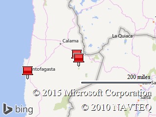
So what in the world would ever be worth such a commitment? Well, the Atacama Desert is without question the driest non-polar place on Earth. It is a plateau which covers over a 650 mile strip of land along the coast of Chile just west of the Andes. It lies at an elevation of almost 10,000 feet, and has an otherworldly appearance which has been compared to that of Mars. In fact, several movies have been filmed in that location, but of greater interest is that NASA has used this huge valley to test out its lunar equipment.

We drove 4.5 hours to the small town of San Pedro de Atacama with only one stop along the way. Along the way, we were witness to the most amazing scenery, however, taking pictures from a moving bus does not really do justice to what we saw. When we arrived, we expected to find a local village which was largely unknown, but boy were we wrong! The little town was jammed with some tours, but mostly young people who had come there to enjoy the many outdoor experiences offered in the surrounding areas. It was full of hostels, hotels, cafes and little restaurants. On literally every corner was located a small travel agency hawking tours to the surrounding areas.

Our free time was limited by our tight schedule, and right after lunch, we left for another hour long ride into the high desert; much of the drive being on dirt road. Our first stop was to visit a nature reserve which is attempting to protect the surviving flamingoes that at one time existed in large number around the salty Lake Miscanti. Two things struck us in this environment. First with the cloudless sky and a burning sun directly above, the white salt flats created a situation in which the UV index was off the scale. It felt somewhat like being in a microwave oven. The second thing which caught our breath, was that at any point on this plateau is that just to the West are the high mountains and volcanoes of the Andes, many of them snowcapped, and that vista literally stretches from horizon to horizon.

All along our little walk were huge salt crystals, and salt flats which stretched to the horizon. In fact, one of our guest pointed to what I took to be a large rock on our path and it turned out to be a single salt crystal that looked to be the size of a cinder block. We did get some wonderful photographs of the surrounding mountains and the huge salt flats, along with seeing some of the surviving flamingoes. No one could stay out very long in the searing sunlight, and so before long the bus was headed back the way we had come. Upon reaching the little town of San Pedro de Atacama, we turned back onto the highway home, but the day was far from over.

Before long, we once again departed the main highway for a dirt road which brought us to the ranger station for “The Valley De La Luna.” After stopping to pay the entrance fees and to take a quick break from the bus, we were soon bumping along a small dirt road which was taking us deeper into the beautiful valley. Everyone in the bus was now fully awake and all were equally awed by the surrounding beauty. There was one fantastic picture after another except we were still on the bus, and I was chaffing to stop and take photographs which we did soon enough. The bus had driven to the end of the long road and then on the way back made several photo stops. The Valley which is famous for its resemblance to the surface of the moon is perhaps even more famous for the truly magnificent vista over the valley which occurs at sunset. When we first entered the Park, it was mostly devoid of people, but as time passed I noticed a huge influx of cars and small vans loaded with people. Like little ants they started to climb the hills in order to be at the top for the “big event,” sunset. At about this time, our bus departed the Valley, and once again entered the highway for our long ride home. Even though we were running late, surely we could have stayed just a little longer!

Surprise! About two miles or so up the road, our bus turned onto a small and from the look of it little used road which headed into the hills. There had been no announcement of another stop, so I could not imagine what this was about until we pulled onto a plateau which looked over the entire Valley and surrounding mountains and parked all alone beyond the crowds. Not only was the view out of this world, but the tour operator had setup a large wine and cheese event complete with local natives demonstrating their sunset ceremony. OK, we were impressed! In fact, there were actually little rock seats that were created for our use.

At one point, I moved away from our little group and sat by myself in relative silence, looking over a truly awe inspiring vista as the sun was setting. Quietly in my mind I heard the words: “Be still, and know that I AM God.”

Jim

Wednesday, October 28, 2015

To Touch the Sun


Map picture


The last two days have been a blur of activity that has left us exhausted; not to mention, that tomorrow promises to be a 15.5 hour outing. So, excuse me if I am of necessity brief in my describing our experiences.

On Oct. 26th, our ship docked in the port city of Matarani, Peru. From there, we set out on a 12 hour roundtrip journey to Arequipa, Peru. We traveled into the mountains along the main highway from Peru to Bolivia. The road, while a well-constructed two lane highway, was none-the-less a very winding pathway up the steep mountains. It was also filled solid with traffic, most of it being large cargo carriers. I remember at one point, I looked out the window and counted 9 large trucks slowly climbing the road in front of us. Now the entire length of the road was painted with solid yellow stripes – no passing, right? Not in Peru! Our bus managed to pass up to four of the large carriers at once; not only ignoring the double lines, but also ignoring the oncoming curves. At times, the “two” lane highway became a temporary “four” lane one. All the drivers seemed to understand this unwritten code, and we never saw any sign of an accident. Sadly from the perspective of a photographer, the bus did not stop even one time for photographs, and so the only images I got were those taken through a dirty window while moving along the highway.

Finally, we arrived into Arequipa, a UNESCO Historical Center, but not before a funny story. Our bus was equipped with a “small” bathroom, which I was seated directly across from. Every time someone used the toilet and left the door open, the stench was not pleasant. So even after a very long ride, I avoided going into the little room, even though I really needed to do so. As we entered the city, I asked our guide how long after we departed the bus before we would have rest rooms, and he told me one hour. Well, that did it; smell or no smell, some things won’t wait. Up until now, the bus had been driving smoothly on the highway, but now that we had entered the city, it would stop and start, make abrupt turns – in short getting into the little room was a challenge for someone of my size. I managed to enter, and actually turn around all the while being thrown around like a beach ball. Suddenly, the bus quickly accelerated, throwing me against the door, and causing a small clicking sound. Thinking nothing about it, I finished, and by then we had stopped and people were coming off the bus. I went to open the door, and it was locked with no way to unlock it from the inside. So I did the logical thing and started banging on the little door, but of all the people going by, no one heard me. I started to become a little concerned, and turned to a very small one-way window to look outside. Ah, a member of our expedition team was less than 3 ft. away, and so I begin to bang on the glass. Over all the noise, he really did not hear me, but something caught his attention, and he came over to put his nose on the window at which point, I gave the glass a big bang indeed! Finally free, I vowed to never enter a small bathroom on a bus again.

Our guide very quickly stopped at the historic Plaza de Armas with hardly enough time to take a picture. The beautiful white Cathedral was under renovation and was not only closed, but all covered in scaffolding. Pooh! We then rapidly walked to a famous museum which houses two exceptionally well preserved mummies which were young girls sacrificed to the Gods by the Incas and left on the mountain top, where they froze solid; their remains were discovered in 1995. From there we walked to the Santa Catalina Monastery which was founded in 1579 under the Dominican order. It is considered one of the most important and impressive monuments in Peru. The nuns lived in this large complex until 1972 when they moved to modern quarters next door and the monastery was opened for tourism. On first entering the buildings, I immediately thought I had been there before, but neither Lisa nor I could remember ever having been to this city, much less this particular monastery. As we continued, I started to tell our small group what was coming next, and every time I correct. As it turns out, we had indeed been here in 2013 on the Silver Wind. Yet another “senior moment.”

After a wonderful lunch and some free time in town, we made the long drive back to the ship mostly in silence since everyone was tired. We had departed that morning at 7:30 am and returned at 4:30 pm, a day of 9 hours.

Overnight we departed Peru for Chile, and with it came a 2 hour time change – the wrong way – we lost two hours during the night. So imagine our joy at having to rise early the next morning for a 9.5 hour day. Our ship had docked at the small town of Arica, Chile, which we actually did remember visiting previously. However, rather than staying in town, this visit we traveled into the mountains to an elevation of 11,500 ft. in the Andes. Our destination was the small Chilean village of Putre. Along the way, we stopped several times for photographs, and at one stop we were offered Coca tea which would help us in acclimating to the attitude.

At one of our last stops before reaching our destination a most amazing thing happened. We were already at a high altitude where the clouds were few, the skies deep blue, and the sun blazed directly overhead. After we got off the bus Lisa noted a very unusual phenomena and quickly pointed it out to our small group. Directly overhead was a beautiful circular rainbow. This occurred because a thin layer of high ice crystals had come between us and the sun; a condition which would quickly fade as the high clouds drifted away. It was nothing less than the highlight of our tour!

As Putre came into view, we made our final stop to look down into the valley where it was located. It was beautiful with snow covered volcanos in the background. We finally arrived at our destination to find a small village in which the dusty streets were so narrow that our bus barely made it through to the town square. This was a very out of the way place. Not primitive; I mean they had electricity, plenty of water coming off the mountains, and even cell service, but really out of the way. We walked around the square, slowly because of the altitude, and eventually made our way to lunch. Now lunch was described in advance as “basic but tasty.” Well, let me tell you that this little hole in the wall turned out to be huge inside and the food was delicious. Even though I do not eat salads, even I recognized the quality of the salads being served. They were large, fresh, and the ingredients almost shined. I was given a boiled chicken breast, along with new boiled potatoes which were huge in size. Overall another great meal!

Then came the long drive back. Unlike yesterday this highway was not so heavily traveled, and going downhill we made good time arriving back to the ship around 6:30 pm.

I wish I could elaborate more about our two days, but both Lisa and I are so tired that we took this day to take not one, but two naps since tomorrow will be a 15.5 hour day! Yikes! Also, I apologize about not getting photographs uploaded yet, but there simply has been no time. At this point, it might have to wait until we get home, but I hope not.

I hope everyone is well.

Jim

Sunday, October 25, 2015

Flying High in Peru


Map picture


The last two days have been a blur of activity, which have left both Lisa and I exhausted. We have also had some exciting adventures.

On Friday afternoon, October 23rd, the ship reached the port city of Callao. It is the gateway to Lima, and on my long ago visit, Callao was a small city quite distinct from Lima; not so today. Today the population of the Lima metropolitan area has grown to over 12 million people, and one can no longer tell when driving from Callao into the Lima.

Our afternoon tour was to visit the world famous Larco Herrera Museum, located in Lima. This private collection houses the largest and most complete repository of Pre-Columbian artifacts in the world. “Pre-Columbian” is a term used to designate native art which existed prior to the arrival of the Spanish to Peru. For one hour we were guided through the museum by one of the curators, and the exhibit was nothing short of awesome. It included pottery, and mummies, along with Incan gold and silver. This was a special treat, but alas, that was where the tour went sour. After the wonderful tour, the group was told that we had two hours to look at the gift shop, walk around the grounds, or have an included light snack in the restaurant. Basically we were to “kill time.” Here we were in one of the most historic cities in the world, and we were told to “cool it.” I was really disappointed we did not at least drive to the main plaza in Lima. And so enough of Callao, we’ll move on to yesterday, which was much more interesting.

Our ship anchored at the small town of Paracas. Even though Port Authorities had promised that we could anchor close to the marina, on the morning of our arrival, the Captain was forced to anchor over two miles off shore. This was to be a very long day with our being gone from the ship for almost 12 hours. In the morning, Lisa and I had arranged to sign up for an optional, and very exciting tour which flew us out to see the enigmatic and famous Nazca Lines. Then in the afternoon, we would join the rest of the ship driving inland to visit Tambo Colorado, a well-preserved 15th Century Incan Palace.

So first let me talk a little about the Nazca Lines. They were first discovered by an archaeologist around 1929. Located on a high arid desert plateau and until their discovery, they were literally in plain sight, but simply not recognized. To explain, let’s realize that the plateau is composed of a dry and quite hard white base over which is a thin layer of small stones. When the stones are removed, then the white dry desert is revealed. And so, the brilliant discovery in 1929, was that large areas of the desert had stones removed, but not in some random pattern, but in such a way that seen from above they painted patterns; patterns which produce what are termed geoglyphs. There are hundreds of figures in the 50 miles of the plateau, some depicting monkeys, sharks, llamas, and lizards. There are gigantic trapezoidal patterns, many of which look remarkably like dirt runways. I am told that from the ground, these “patterns” are not visible. They can only be seen from the sky. Since there are no high mountains nearby from which native people could have seen these figures, so how then did they produce such excellent and complicated designs, and for what purpose? I will tell you that if you strip away all the hype that has been written about this phenomenon, in truth, no one really knows who or how these lines were produced. The standard answer which is given to tourists is that they were made by the Nazca people between 200BC and 700AD, but there is not a shred of proof to back this up. There is also a theory that aliens were somehow involved, but again there is no proof simply another theory in a long line of theories. Ever since I first read of the Nazca Lines when I was in High School, I had always dreamed I might one day see them in person. Therefore my flight yesterday could be said to be a “bucket list” item.

We were awakened at 6am in preparation for our long day. First there was the long zodiac ride to shore, then the drive to the airport. To my surprise in order to fly anywhere inside Peru we needed our passports, and of course a full security check, for a 3 hour flight in a Cessna Caravan. I figured we would get some airplane banded together with duct tape, however, to my surprise, our aircraft was equipped with some of the most modern equipment available. After takeoff, we climbed to 9,500ft. We flew southeast along the edge of the Andes which towered to our left. After approximately 145 miles we started our descent, and I could see on the electronic maps being used by the captain that we were going to enter some type of restricted airspace, and from his traffic display, I counted 10 aircraft inside that area already. The aircraft had descended to 3,000ft. and stayed at that altitude the entire time we flew over the Nazca plains. The reason became quickly apparent because aircraft were visible both above and below us all doing the same tour, but at different altitudes; popular place!

Sadly, this is where the experience waned. We were only 1,200 feet above the ground so it was difficult to see an entire geoglyph since some of them covered large areas. When we arrived over a figure, our pilot banked 45 degrees into a tight turn to show us the figure, but seeing only parts of lines made it almost impossible to figure out what I was seeing. I’ll also mention that a turn that steep was required because we were so low to the ground, and it was quite scary for most passengers – in fact, some got sick. Adding to the discomfort, when the pilot had circled a few turns left, he immediately swung into a steep turn to the right, not a pleasant experience.

So all in all, I am really glad I finally got to see the famous lines, and fully enjoyed the experience, however, I am a little disappointed we flew so low and did not get a really good view.

Our original plan upon returning to the dock after the flight was to return to the ship for lunch, then join the afternoon tour. However, with the ship so far away and our tour running late, there simply was no time, and so we decided to stay at the pier and join the group when they came ashore. At the pier, there was a small terminal building, inside of which was setup a small café with tables. We picked a table – not hard because we were the only patrons, and proceeded to grab one of our guides to help with the translation of their menu. After deciding on lunch, we called a waitress over, and he helped explain our choices. That bombed because they did not have that item. OK, so we picked another, and another, and yet another, but always the answer was the same – we don’t have that! Finally in frustration, I put the useless menu down, and asked what they did have. Ham and cheese sandwiches, sodas and beer, came the response. Well, OK we’ll have that! As an afterthought, Lisa asked for some potato chips, which seemed to cause some problem, but she left to get our order. The pre-made sandwiches were located in an uncooled plastic display case, but hey, the beer and sodas were cold.

Now before we could get the food, Lisa had to go to the “Cashier,” a women sitting inside a glass enclosure with only a small opening in which to pass payment. Here the fun begins. The waitress cannot figure out how to write up our bill, and so someone else is called over. This continues until we had five women and a man who appeared to be the top dog trying to figure out the bill. Poor Lisa stood at that counter for almost 20 minutes before they completed the transaction. By the time we had finished eating, we noted that we never got the potato chips, but alas our waitress appears with Styrofoam container inside of which is a really nice order of fresh home-made fries, all hot and delicious. Turns out that was the best part of our lunch.

Our afternoon tour drove us for about an hour northeast along the Pan-American Highway to where we stopped at the Incan ruins known as Tambo Colorado. These impressive ruins have only been recently excavated and offered an excellent insight into just how impressive the skills were of the Incan builders in the late 15th century. A Tambo is essentially an administrative center for the Incas, as well as serving as a waypoint on the old Incan Highway. That impressive road structure stretched down the Pacific coast for over 3,000 miles, and Tambos were located along the road at selected intervals.

Tambo Colorado is in an excellent state of preservation, and it is even possible to view the last layers of paint that were used. Believe it or not, they city had water flowing through it which was used for their toilet and bath system. We managed to tour the main parts of the structure in about an hour, even reaching the highest levels open to tourists. I really enjoyed this, and I hope the pictures do it justice.

Tired but in good spirits we made the hour long journey back to the pier from which we could see that the ship had been allowed to move closer in our absence. I figured that would make for a faster return, but sea conditions had changed dramatically. When we had departed that morning, it may have been a long run, but the sea was so smooth it looked like a mirror and there was not a breath of wind. Now the waters had a meaner look, and we had strong winds. In the end, let’s just say it was a wild ride, and everyone was soaked to bare skin. Ah, the joys of adventure cruising.

Jim

Saturday, October 24, 2015

Déjà Vu, All Over Again

Map picture

In preparation for our visit yesterday to the Peruvian city of Salaverry, we had the usual briefing the night before during which a picture flashed on the screen which instantly brought back memories of having seen this structure. I even remembered the name, The Temple to the Sun. How could that be? I had never been to the town of Salaverry. So I started asking some questions of the expedition staff, but all that I came up with was that I was mistaken and confusing this with some other monument.

After our arrival into the small town of Salaverry, we boarded busses that quickly entered the Pam American highway headed into the third largest city in Peru, Trujillo. Again I had a flashback – I knew that name, but why? I actually have a list of every cruise port we have visited, and neither of these cities is on that list. Of course, I did travel before we took up cruising, but I just could not remember.

We arrived into the historic center of Trujillo, where we got off to walk around the Plaza. On our drive in, we were witness to the same development seen earlier on this trip. We had a fairly modern and bustling city surrounded by small one room shanties. We even saw a large area of “dwellings” which consisted of nothing but cardboard and bamboo boxes that stretched in long lines; clearly Peru is in transition.

The Plaza was immaculate however, and very beautiful. A Cathedral dominated one end, and surrounding the plaza were historic buildings. Some were luxury hotels now, some were government buildings, and one was a fully restored residence which we went to visit. However, our real purpose in visiting Trujillo was to go outside the city to the Valley of Chicama where discoveries in the last 25 years have revealed one of the most important archaeological finds in all of Peru-- the ruins of El Brujo, a ritualistic complex of the Mochica Culture, who thrived from around 1 AD until 740 AD.

Leaving the city, brought us to a turn off onto a small winding road with structures on both sides. That creepy feeling started to come back, and I had visions of this as an old dusty road where people walked or rode donkeys, not one paved with traffic. The road came to a sharp turn and there in front of us was the enormous Temple to the Sun, and I recognized it immediately. It is one of the largest adobe structures in the world, and I can vividly remember climbing to the top to survey the surroundings which at that time was just a few small farms. I was told that it was believed that an important city was in the adjoining field, but it had never been excavated. As it turns out, that suspicion was all too true since when digs started in 1990, they located an incredible find. Now I remembered the city of Trujillo, but why had I come there – well, I searched my map and found on the other side of the city, the ancient Mochican city of Chan Chan. Some 40 years ago I had come to this city on a one day excursion from Lima to see the ruins of Chan Chan. The Sun Temple was an afterthought to kill time while waiting for the late flight back to Lima.

What archaeologists have uncovered rivals work by the Egyptians. After our arrival to the complex yesterday, we set out to visit the massive digs which are still very much a work in progress. Our first problem was to navigate the 175 stairs to climb the 300 ft. to where the digs were visible. Slowly but surely Lisa and I made it, only to find that that may have been the top of the stairs but once inside there were many more stairs. Still what greeted our eyes was amazing! Buried beneath the dry desert for hundreds of years was a richly constructed decorated structure that for the most part still retained its brilliant colors. We walked around under the scaffolding simply amazed when a member of our expedition team said, “the best is yet to come.” Climbing further we came to a rather steep ramp down almost 150 feet at the bottom of which had been uncovered a huge wall which was richly decorated with colorful friezes and colored relief panels. I was truly amazed. We were running at that point because touring the ruins had taken longer than anticipated and suddenly we were being told we had 10 minutes to get back to our busses, BUT it had taken me 40 minutes to walk this far. I then heard a commotion and turned around to see Lisa being taken away in a police car while she frantically waved at me from the back seat. WHAT? Lisa arrested in Peru – this is about to get serious. What in the world had she done, step on some sacred stone? I ran to where a crowd had gathered to learn that far from being arrested the police had kindly offered to drive her back to the bus since there was no way she would have been able to make the walk. Quickly I decided to get “arrested” too! It took some effort by the expedition team, but about 15 minutes later the police showed up, and out steps two attractive young women, both armed mind you, and I went up and told them just to put the flex cuffs on and arrest me, too. We all laughed, and they got me back to the bus in plenty of time to spare without the flexi cuffs.

After lunch, the ship anchored off some small islands which were home to huge colonies of birds and sea lions where they offered a 90 minute zodiac tour around the islands. Lisa and I were so tired that we opted to take a nap, and I think wisely so. I went up on deck to take a picture where the smell of guano wafting from the island was so strong – I can’t imagine getting closer.

Tomorrow morning we have a bit of a break before we visit a very famous museum in Lima, Peru in the afternoon.

I am sorry I am so behind on my pictures and e-mails, but this is a really busy cruise, and last night we stayed up late having a private dinner with the Captain.

Jim

Friday, October 23, 2015

Robbery on the High Seas

Map picture

Today we were set to visit a small island off the coast of Peru, named Lobos de Tierra. The island is home to large colonies of sea birds, and as such was a large source of guano deposits. In fact, by 1863, it is estimated that over 7 million tons of guano were removed from the island, and sold to the mainland as rich fertilizer. Only small deposit remain today, and our visit was not to see guano, as fascinating as that might be, but to visit the large colonies of the Blue-footed Booby and the Peru Pelican that nest on this small desert like piece of land.

Now I must confess that for whatever reason, I had a crisis of confidence this morning and became quite agitated and nervous. What would cause such behavior? Well, I could not figure out what to wear. You would have thought I was dressing for the prom rather than merely going ashore to a small island.

So first I had the issue of what shoes to wear. We were advised that they would try to have us step onto small stools in shallow water, and hopefully step onto a dry sandy beach. Well, did I wear shoes for a wet landing, or a dry landing? Then I had the issue of clothes. Until now the weather has gone from downright hot and humid to just hot, and then to warm. This morning was a different animal; it was 66 degrees when we awoke, and there was a strong wind. I reasoned that I would be too cold in shorts, so I decided on jeans – but wait, what if the sun came out and the temperature really did rise to 73 degrees as forecast? I’d probably be more comfortable in shorts, particularly if there was a wet landing, or I got wet on the ride over from the rainclouds ominously gathering on the horizon. But, if I wore shorts, then I would need white socks. I mean all this could drive a fella nuts! In the end, I dressed in jeans with my black compression socks, and put on my hiking boots. Then I was freezing in my microfiber shirt so I changed into a warm polo, at least the first time.

Before long, doubt started to gnaw at me. Maybe I was dressed too warmly, and if so, on the long walk along the desert like island, I would be too hot, and if my jeans got wet on the landing, then I would be walking around with wet jeans and squishy socks. Squishy socks! Oh my, that won’t do, and so for the 100th time, I asked Lisa her opinion, and I could tell she was tiring of this game, so with the clock ticking against me with our departure from the ship set for 9:30 am, I decided to completely change my clothes! Gone were the jeans, gone were the black socks, gone the warm polo, and the shoes just were not the right ones. By the time I finally got recycled, it was past our departure time and yet, nothing had happened. Curious?

Well it seems that even though the ship had all the proper paperwork and permissions which would permit us to visit the island, the people on the island refused to recognize them as valid. The “people on the island” as it later turned out were a motley group of men who were still doing a small business of mining guano, and in the process had been given the assignment by officials to serve as the gatekeepers. Our 9:30 am departure slipped to 10 am, and then to 10:30, and as time dragged on, we were simply advised that we would be so advised when arrangements could be made. Phone calls went up and down the food chain, but apparently the miners were standing their ground. Just before noon, an announcement was made that in a spirit of good will, the miners had been invited to lunch, and by the way, we now had clearance and would go ashore after lunch.

Now, I have heard different stories, but I think most people on board suspect that it was not just a free lunch they wanted, but perhaps some other “considerations” too. So in short, the Silver Explorer was submitted to extortion, or as I call it, “robbery on the high seas,” before we could be permitted ashore by a group of guano miners.

Moving on, we finally took our zodiacs ashore, to find a barren desert like island that we were told at one time was covered by guano rising 30 ft. above the ground. Today only small deposits remain which were not visible from our vantage point. We set out in small groups to explore the surrounding area. The shore side was literally covered with Blue-footed Boobies, so much so, that it was a challenge to walk without hitting one. These adorable little birds live their entire lives at sea, with the exception that they come ashore to mate and raise their young. We got to observe and film their elaborate mating behavior, as well as watching them waddle around on their big blue web feet looking for a partner. While on land they may look comical, but at sea they are absolutely amazing. They will dive straight down in large groups on their prey, entering the water at speeds approaching 100 mph. Also on the island were a large number of Peruvian Pelicans. We could see them flying everywhere, however, they were much shyer, and I never actually got near one on the ground.

We had a guide that would walk 10 paces, then stop and talk for 10 minutes. He kept repeating this over and over. It was very boring and so I broke away and headed in the direction of the abandoned building from the old mining days. They were actually quite interesting, and included the twisted remains of the old railroad which was used to haul their product to the long dock nearby.

Having walked for almost an hour on rocky terrain, I was rightfully tired and went back to the ship joining Lisa who had given up earlier.

Well, this is expedition cruising at its best! Unpredictable and interesting which is what we enjoy so much.

Jim

Tuesday, October 20, 2015

Iguanas Anyone?

Map picture

Early yesterday morning the ship completed its long overnight journey upriver to reach the inland city of Guayaquil, Ecuador. This was to be a “turn around day” which is when one cruise comes to an end, and another cruise starts. Our first cruise was almost at full capacity with 115 passengers. There is a group of approximately 24 who are staying on for the next one, and the current number of guests are 90. So as you may imagine, a turnaround day is a very busy time onboard any ship.

For those of us who were “in transit,” Silversea offered a 3 hour morning tour of the city. I was amazed at the size of Guayaquil. It is the largest city in Ecuador, with around 3.7 million people in the greater metropolitan area. Our drive to the main thoroughfare in the city called “9 Ave Octubre,” took a good 30 minutes as we threaded our way through the suburban area traffic. Here we saw the typical small shops which sold everything and offered any type of service from a dentist to a bicycle repair. Most buildings were one story with an occasional two story structure. When we reached the main road of the city, however, the scenery changed dramatically. We found ourselves surrounded by modern shopping malls and large skyscrapers. While stopped at a traffic light, I looked ahead and it seemed that the boulevard stretched on forever in a never ending stream of traffic lights. At that point, I could see roughly 40 traffic lights in a row before they faded into the distance. Clearly, this city is very much one in transition from the old to the modern, and all in all, it was very impressive.

At first, I was afraid that this would be a “spam in a can tour,” in which we rode around, stopping briefly to see some sights, but never actually getting off the bus. That turned out not to be the case, but in truth, I don’t know where the traffic would have allowed us a place to park anyway. We finally reached Bolivar Park, where we could disembark the motor coach, and head out for about a mile walk. First, however we all had to visit the impressive Cathedral which dominates the Park. Then within the park itself, we had to be careful where we walked! Why? Iguanas! Not little lizard type iguanas, but BIG Galapagos type iguanas. They were everywhere. On the walkways, on the benches, up in the trees – just everywhere! It was, to say the least, an unusual sight.

From the park, we walked past the City Plaza, City Hall, and finally to the Guayaquil river. There we headed north along the beautiful river walk, until Lisa finally said that her hips would go no longer. I was not good for much more, truth be told, and so we sat on a big bench together under a massive Ecuadorian flag, and waited for our bus to return for us getting in some good people watching.

And that, my friends, was our day in a nutshell! I usually try to find some amusing story to tell, but alas, nothing unusual happened, and so, we returned to our new home, the Silver Explorer, ready for the coming adventures.

Jim

Sunday, October 18, 2015

The Mad Hatter

The Mad Hatter

Map picture

Yesterday, we docked at the large port city of Manta, Ecuador, where we were dwarfed by the large Holland American ship next to us. In fact, that ship was so large, by comparison, the Explorer looked like a small yacht.

Lisa and I have been to Manta several times, so I was apprehensive that our visit ashore would duplicate something we had already done. Well, we need not have worried about that. Silversea had arranged for four large busses to transport all of the passengers and expedition staff 90 minutes south along the coast to what was described as a “Boutique Resort and Spa, named Las Tanusas.” There we would be treated to a lunch of local cuisine, after which we would be entertained nearby to a sample of The Rodeo Montubio. This was described as “a popular and traditional coastal festival that takes place every year” among the local cowboys, known as Montubios, all of whom will be wearing the traditional “Panama hat.” Now I don’t know about you, but since we are in Ecuador, what can be so traditional about a hat made in Panama?

Our bus made its way through the city traffic, and soon we were headed south on a well maintained two lane highway designated E15. The first thing to strike me was the complete change in scenery from just the day before. Until now, everywhere we visited was replete with lush tropical vegetation, high heat, and humidity. Now the landscape surrounding us was dry desert with moderate temperatures and little to no humidity. What caused this dramatic shift in climate was the impact of what is known as the Humboldt Current, a cold and massive outflowing of water from Antarctica.

As the miles droned on, so too did our local guide. The one thing I remember was that he kept pointing out small communities which were known for their skill at producing the “Panama Hats.” Enough already with the hats! The scenery was what I would call uninteresting and monotonous. For miles and miles was scrub and desert broken only by a small town or village here and there. Soon I found myself nodding off, and I gather that I was not the only one.

Eventually the busses turned onto a dirt road which wound around and around finally bringing us to the resort of Las Tanusas. I must admit that the staff and locals had gone to great lengths to produce a spectacular setting. We were met by a local band known as a Banda de Pueblo. The tables were all decorated and carefully set. The “resort” seemed to me to have only 3 to 6 rooms, I could not be sure, however, it was a beautiful setting with a sandy beach in front of us, and a cool almost chilly breeze. The meal was all seafood which left Lisa and I out, but we knew that going in and arranged for room service before we left the ship. Even though I did not eat the meal, the presentation was excellent and the service top notch. I gather the property was fairly new and we met one of the owners, a young couple with a big dream. Not to throw water on their vision; it is a very small property out in the middle of nowhere, and they want $350 a night for a basic room and $650 for a suite.

As we finished lunch, people wandered out front where the tour operators had arranged for a selection of local handicrafts – and there on display were those pesky “Panama Hats.” Suddenly I hear my name being called, and turning around there is Lisa wearing one of these hats, asking what I thought about it. Having been married for 31 years I knew there was only one answer that I could give, “it looks great.” I should have stopped right there, but I then went on to ask how she was going to get it home, and how much did it cost, etc. Lisa looks up and tells me to just go on to the bus and leave her alone. Whoops – I’d done it now!

Unfortunately, our bus was parked at the end of a long line, and it was very difficult to reach. Finally aboard, everyone is ready to go, but Lisa is not in sight. Suddenly she appears, out of breath and not very happy. She plops down in her seat and scowls. Since no hat is in sight, I politely ask if she is OK. Well it seems that she did indeed find a hat, came to an agreed price, but when she went to pay she did not have enough money and her credit cards were back on the ship. {Secretly I am thinking to myself, Whew!} Without warning Lisa turns to the people next to us, and asked if they could loan her enough money to buy her hat and they quickly produced the funds. Now with the bit in her teeth, Lisa stands up to go back for the hat, but alas, the doors are closed, the count is finished and we are on our way! But, a member of the expedition team grabs the money, stops the bus, and runs for the hat. She returns with the owner of the shop in tow, who has not only reduced the price, but placed the hat into a beautiful bag for safe transport. And to this, the bus breaks into applause!

The Mad Hatter

OK, so I admit, it is a beautiful hat, but now I am curious as to why the hat is not called the Ecuadorian Hat? There are many historical reasons, however the defining moment appears to be when Teddy Roosevelt was photographed at the Panama Canal waving his woven hat to the crowd. Writers of the day mistakenly referred to it as his Panama hat, and the label has stuck ever since. ,

We then drove across the highway to a large dusty area where large corral and a viewing stand had been erected from scratch in order that we could be witness to a Rodeo. At first, I found the show entertaining, but I quickly became bored with all the yelling and amateurish activities. When one of the horses was running around the ring screaming out in obvious pain, I suddenly realized that the cowboys were using spurs. That did it for the performance, and people quickly started to drift back to the busses. As we departed, our local guide apologized for what had happened, and stated that the use of spurs is against the law in Ecuador. So in the end, we spent 5 hours off the ship, and frankly, this was the first time I was disappointed in the adventure.

Moving on, overnight the ship repositioned to the Isla de la Plata, a small rocky landmass which is only 35 miles from Manta. When we arrived, it was windy with a large swell, and left too our own zodiacs, the short trip ashore would not have been a problem. However, local officials did not want us to use our boats, instead the wanted the ship to pay locals to transport us across in their fishing craft. After an hour of trying as best they could, the locals finally admitted that conditions were too rough for them, and so at last we could go ashore using our zodiacs. Lisa and I elected to stay with the ship, since once on shore, small groups would set out for a 2 to 3 hour hike which first involved climbing 175 steps up the steep mountainous terrain to an elevation of 1,500 ft., and then coming back down again. They were visiting this National Park in the hopes of viewing some of the birds usually found in Galapagos, nesting here. I just spoke with one of the guests who returned, and his comment to me was “You were wise to stay on the ship. Yes, it was beautiful, but it was a real bitch!”

So this afternoon and tonight our ship will travel inland traversing the Guayaquil River into the city of Guayaquil. Tomorrow will be a transition day marking the end of one cruise and the start of another. We did sign up for a local tour, so let’s hope that is better than our experience in Manta.

Jim

Friday, October 16, 2015

What’s With the Rubber Boots?

Map picture

Departing Bahia Solano yesterday afternoon, the Explorer cruised at a good clip in order to reach the isolated and little known island of Isla Gorgona. Before arriving, every passenger was issued a knee high pair of heavy rubber boots, and all we were told was that this was a requirement of the National Park Service for anyone going ashore.

Isla Gorgona is still in Columbia, and as our information sheet states, it “is an exotic destination by any standard.” The island is a UNESCO World Heritage Site and a National Natural Reservation Park. It is covered in lush tropical foliage and forests. Located only 35nm off the Columbian coast, it is also a good stopping off point for drug smugglers, which accounts for the presence of heavily armed police units; in fact, during our visit we were escorted by an armed officer. The island is 9 km long by 2.5 km wide. In 1959, the island was turned into a large maximum prison facility, similar to Alcatraz or Devil’s Island. The prison was closed in 1984.

This morning we were in the first group to go ashore for a wet landing onto a pebble beach, and from there were escorted to a small room to be briefed on our visit. There were a number of buildings in the compound, mostly now for the housing of Park officials and for the Police units. Until 4 weeks ago many of these buildings were part of a resort which was operated under contract with the Park service. The private contractor abruptly closed the facility down and left the island.

During our short briefing about the island, its history and current status, it became apparent that the knee high rubber boots were to protect against snakes. It seems that the one thing the island is famous for is the large diverse snake population including the Boa Constrictor.

From our small meeting room, we set out to visit the old prison. The temperature was moderate because of the overcast skies, however, the humidity was bloody awful. Our cameras, having come out of the air conditioned ship, were frosted over with condensation, and therefore useless until they adjusted to the temperature change. We are very familiar with the problem, and for that reason try to warm our cameras outside in plastic bags before going ashore, however, the humidity was so high, that even that trick alone did not solve the problem.

The prison tour was depressing, and wet. Moisture dripped from the dense foliage, and I can scarcely imagine a more depressing place to have to be imprisoned. We got some pictures, but the lack of light in the dense jungle made getting good photographs difficult.

By the way, did I mention snakes? I figured that on the trail the chances of actually seeing one would be small – WRONG. Someone yelled out, and not four feet from where we were was a large Boa working its way along the jungle floor. It was disturbed by our presence and so started moving away, but I did get some photos of this magnificent creature although they are not too good.

In our journey south along the Pacific coast of South America, we have now crossed over the equator, thus necessitating an appropriate ceremony with King Neptune. What an ordeal for first timers who are crossing the equator! Butter was smeared all over each one’s face; then wiped off with a pirate’s knife blade while forcing the person to kiss a long, dead fish; and finally having them drink some purple or green concoction. There were quite a number of guests who went through this process all the while having a good time.

That will bring this day to a close and tomorrow should bring us into Manta, Ecuador.

Jim

Thursday, October 15, 2015

Kidnapped In Columbia!

Map picture

Early yesterday morning we anchored off the small town of Bahia Solano in Columbia. Naturally, having arrived into a different country there were the necessary clearance procedures. As is usual in these cases, the entourage that boards the ship goes way beyond the required officials. It seems to include family members and friends, all carrying cameras and all looking for the restaurant. In fact, while I was using the elevator, the door opened and the hallway outside was jammed packed with the so called “officials,” cameras at the ready.

As usual, our disembarkation was delayed while the “procedures” were completed which while I do not know why, I suspect involved some gratuities for the appropriate party. What really struck me, however, was that circling our ship was a rather large high speed boat from the Columbian military with 4 heavily armed men glaring at us while we dumbly stared back at them. This struck me as really funny. Do they really think a bunch of drug smugglers are going to sneak into the country in a large previously scheduled passenger vessel? About all we could do against their guns was to throw at them yesterday’s dinner rolls. Amazingly just as soon as the ship was cleared, they disappeared having insured, I guess, that appropriate hospitality was extended to the visiting “guests.”

Our zodiac ride to shore was a rather long one because the large tidal conditions in this part of the world required the ship to anchor far off shore. We were able to make a dry landing onto a dock, but then we faced a long walk into town. Fortunately, we had been advised that arrangements had been made for people who chose to be driven into town. Whoops – we should be careful what we asked for! Walking outside the small terminal we were greeted with what looked to be a strange contraption which the locals call a “Chiva.” Ours appeared to be hand built onto what looked to be a circa 1930’s Toyota truck frame which had three wooden benches, all covered with a roof and an elaborate paint scheme which could only be called garish. The one little step was so high that it took three people to push us up, and even at that, the opening was so small to enter, that more than a few hands pushed on our butts as we squeezed onto the bench.

Happily settled, we started off on our journey into town. Unfortunately, the road was unpaved mud covered by a series of one large pothole after another. I truly believe that whoever had built this contraption forgot one thing – springs! More than once I hit my head on the roof. If I thought the zodiacs were rough on my back, I just found something that could beat them hands down.

We finally stopped to visit the town center and the local elementary school. I was surprised at how all the children were so neatly dressed in their uniforms. We were welcomed inside and the children loved our attention. After a while, I drifted away from the group to take pictures, and I then begin to get a feel for the community. While the streets were not paved, there was a project underway not only to install a modern sewage system, but also to wire internet cable. There were little shops everywhere, and it appeared that virtually anything you could want, was for sale. Next to the grade school was their High School. Here again the students were neatly dressed, and I learned that education was free and that the uniforms and meals were all paid for by the Columbian Government. And while this little town may not be reachable by road, it has an airport, and the entire time we were visiting, there was the sound of one turbo-prop after another coming and going. They were used to bringing supplies into the community, and to carry the fish and other products out.

Since I had left the group, preferring to walk rather than to get back in our “limo,” I told one of the staff that I would be walking to the nearby church, and he advised that I should wait there and that he would have our group and the Chiva join us. So I dutifully visited the church, went outside to take some pictures, and as advised, the little Chiva showed up and parked in front of the Church. With my leg starting to hurt, I went over and the wizened little old driver jumps down and miraculously produces a plastic soda crate so that I can climb on board – now I wonder why we had not seen that come out initially?

And then it happened – “I was kidnapped, well kinda.” I could see the driver becoming anxious and looking all around, when suddenly he started the truck and begin to drive all over town. At first I was enjoying the tour – then he became more frantic and I started being thrown all around, every pothole an anguish on my back. I started calling out in jest to fellow guests that I was being kidnapped, “Help! I’m being kidnapped!” But as he became more frantic, I realized that he thought he had lost his group and was desperately trying to locate them. Finally, we went by a member of the expedition team who spoke Spanish, and I managed to yell loud enough about the problem that she came running and got our driver to stop. She had a radio and was able to sort it out and to send the little driver back to the church, where he and I both sat and started to laugh about the situation. The only thing he and I could communicate about was that he owned three dogs; this after a dog passed by, and he held up three fingers. Since I have four of the little friends, we were soon best of friends.

Lastly, the community held a cultural performance which was very interesting, and to my surprise, standing on the side was a lone figure wearing mirrored sunglasses and a hat pulled way down on his face. It took me a while, but I realized it was the Captain! The very same Captain that we had in the South Pacific; this led to some interesting conversation with him, and soon thereafter, the rest of our group appeared, and it was back to the ship for lunch and a quick nap.

During this time, the ship sailed at full speed south along the coast for 135 nm to anchor in Nuqui Harbor, a small cove within the Utria National Park. This has to be one of the most remote Parks in the world. In fact, we were told that few Columbians even know about it, much less visit it. It can only be accessed by boat and that is a long journey. The park is a vast and diverse ecological system which receives almost constant rain. While rain was forecast for our visit, as if by some miracle, it was a pleasant sunny day. Fortunately for us, the Park offers a unique way to see the interior and the adjoining mangrove swamps, they have built a long and beautiful boardwalk which has been cut through the dense vegetation so that people like us can actually see some of the wonders. We went ashore for a wet landing at the small visitor center. The walk was to our left, but before we even got to that point, I spotted a line of ants all carrying cut leaves in what appeared to be a never ending line. I could spot neither the beginning nor end of this tiny caravan, but it was amazing. Lisa and I walked most of the length of the walk before turning around. Along the way, we saw birds, lizards, crabs, needle fish, and did I say birds? The fauna was spectacular, and all in all, a very special afternoon!

Returning to the ship, Lisa and I again fell asleep, but when I awoke she had prepared a little celebration in our cabin before dinner, and then went up to eat under the stars. Unfortunately there were no stars, and only the lights of two small fishing boats far on the horizon, but get this, I looked at my phone and it had a shore based cell signal. What that came from I’ll never know, so I sent our daughter a text, but before I could send anymore the signal had disappeared and we had only the ship’s system which is too expensive to use.

After a long and rewarding day, Lisa and I cooked our huge Kansas filet mignons on a hot rock, enjoyed a bottle of wine, and marveled at having done so well and being so fortunate.

Hope everyone is well, and since today we are taking a break, I hope to get some pictures done this afternoon.

Jim

Into The Wilderness – The Darien Jungle


Map picture

Into The Wilderness – The Darien Jungle

I do not usually write about an adventure until it is over, however it appears that the next two days are going to be very busy. So, having a few moments before we depart the ship, I thought that now would be a good time to explain what I think is going to happen.

Last night after clearing the Panama Canal, our ship cruised south along the Panamanian coast for approximately 145 miles, anchoring about an hour ago in the San Miguel Gulf. We are now positioned at the mouth of the Mogue River, which will be our highway into the Darien Jungle. We will travel up river with the rising tide for 12 miles in order to reach the Embera Village, a journey of almost two hours. The Embera are one of several indigenous tribes which inhabit this remote jungle. There are no roads through the jungle, and last year our ship became the very first vessel to have passengers visit the village. At our lecture this morning, it was carefully pointed out that while these people live a primitive life, they are a modern people who have chosen to isolate themselves in the jungle. We will visit their schools, and we may even see a cell phone or two – yes, amazingly when we anchored we got a weak signal in our room. So it might be said that they are living in a period of transition. It reminds me of what we found in the South Pacific. The people there lived in isolation, but they knew of the outside world, and many of their young adults are leaving those communities to seek their fortunes in the modern world.

In any event, our caravan of zodiacs and local canoes is set to depart the ship in 30 minutes and to drive inland with the rising tide; where we are going is completely tidal dependent. So much so that when it is time to depart, we were told not to loiter or we could become stranded overnight. So, I’ll stop for now and hopefully be back on the other side.

It is a new morning! What I can say in a nutshell is that the living of the experience of it was, shall we say, a little different than imagined.

Lisa and I got ourselves all ready for a long ride in the zodiacs. Water bottles, insect repellent, sun screen, cool shirts – shorts, and wide brimmed hats: to this we added waterproof bags for our cameras and life vests. Once outfitted, we grabbed out walking sticks and set out looking for adventure. Today, we were in the first group to board our boat, but unlike most days when we would have set out on our own, we had to wait until the entire ship was loaded. The torturous route up the river and through the mangrove swamps required precise navigation and local knowledge. Since the ship does not carry enough zodiacs to hold all 115 passengers along with the entire expedition team, several local wooden boats were hired to ferry people. We boarded our zodiac at 12:30, and then had to sit under a blazing sun while the remaining boats were loaded. The black colored zodiacs quickly became so hot that you could burn your hand if you touched them Fortunately our driver saw the problem as we all turned red, and he nudged our little zodiac right up under the stern of the ship, and pushed against the huge vessel as if it was going to move it. That didn’t happen, but in that position, we finally had some shade from the blazing sun. Eventually, after almost 50 minutes of sitting, the caravan was ready to head up river, but first we had to reach the river! Because of the large tidal swells in this region, the Explorer was anchored very far off shore. In fact, we could not even see the mouth of the river where we were headed, and when we reached it and looked back, our ship was barely visible on the horizon.

Finally our caravan, which I am guessing included almost 20 little boats, entered the river and we headed into the rain forest. At first, we made good time, turning up one channel after another until there was no way I could remember how we had gotten there. Every boat carried a little GPS unit which was programmed with check points along our route. Even so, a few wrong turns were made and as we got even further up river, it narrowed and our progress begin to slow. At some point, we were down to a crawl as the little boats had to navigate around huge logs, sticks just sticking up at the waters top which could rip open the bottom, and of course, sand bars. Some boats became grounded and we waited while things were set right. Some channels were not navigable, and we backed up, and all the while we found out why they call it the “rain” forest, because it begin to pour. Our sunny day disappeared, and all around us in the hills, we could hear the thunderous sound of lighting – non-stop lighting. Quickly everyone and everything was soaked. Lisa and I had waterproof bags for our cameras, but Lisa’s had an unexplained hole in it, and I did not shut mine correctly and my camera became damp. We were the lucky ones. We understand that many people were not prepared for heavy and continuous rain and they lost their cameras on the first outing.

After almost 3 hours, we turned a corner in the river and heard native music welcoming our arrival. The water level was still too low to allow us to reach the concrete stairs the village had so carefully prepared, and so we pulled up on a steep muddy bank, where strong hands effortlessly pulled us to shore. We all the set off on a muddy path along the river eventually reaching the concrete sidewalk which had been created for us. There was only one BIG problem. If you have a concrete surface in a warm wet environment, it quickly attracts mold and growth rendering it so slick as to be more dangerous to walk on than the muddy gully’s on the side.

Lisa and I really struggled! We had been told that the walk to the village was a 10 to 15 minute walk. It took the two of us 45 minutes, and at several points, we started to turn back. However the rain stopped just as the village came into sight, and so we struggled on to reach the main group – obviously everyone else had long ago reached the village square.

The Embera natives were all very friendly, and colorfully dressed. Many of the women went without bras, while others either did wear a bra or at least made some effort to cover themselves. They were elaborately tattooed, but sadly no one spoke English. They lived in homes built on stilts high above the ground, and most were without walls leaving the living space open to catch whatever breeze there was.

While I looked around, the natives put on a short cultural show after which they displayed their wares for purchase. Actually the handicrafts were of exceptional quality, and I believe almost everyone made at least one purchase. Lisa and I were getting nervous about the long walk back to the boats because if you will remember we were told that if we missed the tide, we would be stuck for a day. When it started a torrential downpour, the cameras quickly went away and we headed on the long and difficult walk back. This time we were going slightly downhill and the surface was very slick at times. It felt as if we were walking on ice so for Lisa and me, it was a very slow walk, but we finally made it. We may have been the first to depart the village, but I think we were the last to reach the boats.

Awaiting us at the boats was a wonderful sight – the hotel department had gone to a great deal of trouble to have a large supply of cold drinks and snacks. The Hotel Director himself was there along with the Head Chef. What a sight for sore eyes!

All I can say about the journey home was that I did not think we would ever make it. The river was now so swollen from the rain that we made good time getting to the Gulf, but when we finally spotted the ship it was so very far away. Finally we arrived, soaking wet from head to toe. Everything went into the tub, a quick shower, and we both fell asleep – but, we had made it!

I know you would like pictures, but it is all I can do right now to keep up with all the activities. I hope to get to them tomorrow.

Jim

Monday, October 12, 2015

Stuck In the Canal

Map picture

Lisa and I have transited the Panama Canal many times, and in both directions. Speaking for myself, I had the impression that the distance between the Atlantic and Pacific Oceans across the Isthmus of Panama was quite long. That is, for the simple reason, to cross the isthmus in a ship, requires all day. So, for example, today, we are onboard the Silver Explorer currently “stuck in the canal.” Well not actually stuck, but sitting inside the first lock waiting for the huge doors to close us in so that we can begin the slow process of being lifted up to the next level. In fact, as I started to write, all I could see out our window was a concrete wall, the side of the lock which has us imprisoned. But now we have risen quickly to where I am well above the level of the walls.

Anyway, back to my story; in order for our ship to be in position and ready to make a daylight transit of the canal, we had to depart our pier in the city of Colon last evening and travel just 35 miles in order to anchor off the canal’s entrance. This morning the canal’s pilot came on board at 6:45am, and it will not be until 7pm tonight until we finally exit the Panama Canal area. In other words, the transit alone takes 12 hours, but then you have to add to it the time spent the night before just to get into position. You don’t just cruise up to Panama and intend to cross the Canal right then; it is a long and carefully orchestrated process. A little fact is that traffic at any one time is only in one direction through the locks. So you have to wait your turn to go in the direction you wish to travel.

Imagine my surprise when we landed at Panama City on our flight from Atlanta. You see Panama City is on the Pacific side of the canal, and yet our ship was to depart from the city of Colon on the Atlantic side. Yikes! Well, not to worry. Our car and driver arrived right on time at 11am, and in a mere 50 minutes, he drove us along a beautiful 4 lane highway from Panama City to Colon. For the first time, I got to see what was just on the other side of the canal, and it was beautiful! We crossed over the huge Chagres River which feeds the canal from a huge lake in the rainforest. We saw small islands and hamlets inhabited by the Kuna Indians, and Lisa even spotted a sloth lazily hanging from a tree by the roadside. So, I came to realize just how narrow the isthmus really is, but it was also obvious that the terrain was very rugged.

Now no blog would be complete without a little humor – after arriving at our hotel a crisis occurred – I mean a real crisis; Lisa’s bra broke!!!!!!! Whoa is me, what is to be done? I mean it is almost midnight, and tomorrow would be Sunday, where we have to leave the hotel by 11am – and nothing, and I mean nothing is open in Panama City on Sunday morning. Well, first thing in the morning, Lisa gets on the computer and starts searching. Lo and behold, she finds that our hotel is located between two large shopping malls, both of which open at 11am. Quickly, we decide to ask our limo driver to take Lisa to one of the malls and let her run in to find what she needs. In fact, she had scoped out a particular shop which advertised lingerie. Our driver turned out to be a really cool guy and we hit it off immediately. He agreed to our request, but when we got to the Mall the traffic had quickly become impossible. Lisa said to just let her off and she’d phone when we could come pick her up, but the driver would hear none of that. He said that most people in the Mall would not speak English and he did not feel it was safe for her to go in alone. So he pulls into a taxi waiting area, where he is not to park, and leaves me in the car while he sets off to help Lisa.

I was not concerned really, but when 20 minutes passed I found myself looking repeatedly at my watch. Then angry taxi drivers started give me stern glares, and I got even more worried. Twenty minutes stretched into 40 minutes, and I see a taxi driver go over to a police officer and point at my car. The officer walks over with a big frown and starts to walk all around the car. Meantime I try to shrink into my seat and become invisible. Just when I figured I’d be arrested or something Lisa and our driver return both laughing uproarishly. It seemed that the store Lisa found on the internet was the Panamanian equivalent of Victoria’s Secret, not exactly what she was looking for. Since almost no one spoke English, our driver was going around asking where he can buy a bra, which is kinda funny when you think about it. But that doesn’t end there. They find a store, but now he needs to explain to the clerk Lisa’s needs – that raises a few eyebrows. Lisa gathers up some samples and heads for the dressing rooms. When the sizes are not correct, our driver ends up trying to explain to the clerk what Lisa needs – a little larger here, and little looser there and all the while the poor guy is really getting the stares.

He could not have been nicer and we all had a very good time on our short drive across the Isthmus of Panama.

Believe it or not, I do not have any horror stories about our trip here, in fact everything went smoothly, which reminds me why I like Delta. We left Kansas City around 10am and arrived into Panama around 9:30pm. After customs and immigration, we were whisked to our hotel and finally settled in around midnight. Everyone in our hotel was extremely nice. In fact, I can’t remember being treated better. Our arrival at the ship was like a home coming because we know so many of the the people, and last evening, we had a wonderful steak dinner with a good friend and member of the expedition staff, Kara Weller, who is from Nome, AK.

They outlined our trip last night and it sounds wonderful, absolutely not quite what I expected. So hang on, and I’ll try to keep up as we move forward.

Jim

PS I spoke too soon. We now are STUCK IN THE CANAL! Our ship has just been ordered to drop anchor and await further instructions, which they estimate will be another two hours. Perhaps this is a scam and they actually want more money. There must easily be over 50 ships at anchor in this lake, some of which look as if they have been here a very long while. No wonder they can afford to build a new canal, which by the way opens next April.

Friday, October 9, 2015

South America Anyone?

Explorer S.America

Hello everyone - it is indeed that time again where Lisa and I are going to tempt the wilds of South America, of course all the time in the lap of luxury on board The Silver Explorer.

Our journey will start tomorrow with flights to Panama, where we spend the night. The following day we board our ship and settle in. This Monday, October 12 will be spent transiting the Panama Canal. It usually comes as a surprise to many that to travel the full length of the canal will take an entire day. Having done the trip before, we are none-the-less excited by the trip since this will give us our first good opportunity to observe the new and larger Canal that is currently under construction.

I have attempted to include a map with this blog which shows our journey. While it looks OK on my computer, I am not sure how well it will translate across to everyone. In short is shows that we will spend 32 days working our way down the West coast of South America, eventually crossing the equator and continuing on to city at the very Southern Tip of South America, Ushuaia, Argentina.

From your High School days I am sure that you recall that Cape Horn is the actual southern most point of the continent. Actually the "Cape" is located on the small island of Hornos, which is the southermost headland of the Tierra del Fuego archipelago of Chile. The island marks where the Atlantic and Pacific Oceans collide. Since the "Cape" is indeed an island, if the weather is good enough you can actually cruise "around" the Cape, as opposed to ships traveling "round" the Cape from the two oceans.

Yes, I must admit that Lisa and I have been to many of the places on this trip, but not all by any means. In fact there is one "bucket list" adventure hopefully awaiting me in Peru, and that is a flight over the famous Nazca Lines. I have always wanted to see these mysterious geoglyphs which are located in the Nazca Desert on a plateau which stretches over 50 mi. I have seen pictures from the ground and the giant pictures cannot be discerned, however from the air they blossom into a collage of stylized spiders, monkeys, fish, sharks, orcas, etc.

So, if anyone doesn't want these e-mails assaulting your inbox, just let me know, otherwise over the next month I will do my best to keep everyone informed and hopefully entertained.

Jim

By the way, please remember that all of our e-mails are also posted on our blog site at: www.theglobe-trotters.com  In addition if I can I try to post pictures of our journey as we go along and from the web page, simply click on the picture of the penguins and you'll be taken to our photo album.