
My guess is that you have never heard that name before. You might be surprised to know that for one thing it is the name of an atoll. You might also be interested to learn that it is connected to The United States by way of a Compact of Free Association. With that opener, let me see if I can elaborate.
If you have heard the word “atoll,” but do not really know the meaning, then join the club, because neither did I until last evening when I asked the question during our briefing as to what exactly is an “atoll?” First and foremost an “atoll” is a ring-shaped coral reef which at its center a lagoon of water. This ring of coral is the remains of an extinct volcano which has been eroded over time such that the coral has built a reef around the old volcano’s rim. The center of this ring is where the old caldera of the volcano has eroded below sea level and is now filled with seawater encircled by the coral reef. Around the coral rim, there can be small islands or cays, some large enough to be inhabited. The atoll of Kapingamarangi encompasses 74 square km in total area. However, out of this, there is only 1.1 square km of land which is then spread over 33 wooded cays. Today we visited the small island of Touhou and walked over a bridge to its neighbor of Welua Island.
Because of the ring of coral and the depth of the surrounding waters, our ship could not anchor, but did manage to float just outside the coral boundary. Our ride into the village was an exciting one because there is only one way through the coral ring and into the lagoon, and it is a curving channel with strong currents at times. In addition, the village was over five miles from our ship so the ride ashore took almost 30 minutes, and when I looked back I could barely see our floating “home.”
This has to be one of the most isolated places I have ever visited. It is over 300km to its closest neighbors, and the island receives supplies only three times a year, yet it is home to around 400 people. There were no welcoming ceremonies this time just people who had a big smile, and were glad to give us free rein to tour their village.  At the time we visited the island, I was not aware of the connection to the U.S., so I was a little surprised that everyone spoke good English. After returning the ship and doing a little research, I found that 89% of the population over the age of 15 can read and write English. The village was clean, and people were more than glad to stop what they were doing to talk. One gentleman explained to me how he was making a new roof for his home. He was taking dry palm leaves and tying them to a pole about 4 feet long. When he had produced enough of these, he told me that it only took one day for he and his neighbors to replace both the roof and sides of his home, but it will take him 4 months to produce enough material.
  I saw that the island had pipes that delivered fresh water to homes, and I even caught sight of an electrical cord, but I never saw any electrical appliances. Lisa and I walked across a long bridge connecting the two main islands and had intended to visit the school on the adjacent island, but good old Jimbob took a wrong turn, and we never found the school.
  One quick look at our watches told us it was time to return to the dock for our long ride back to the ship. In fact, when our little zodiac exited the reef, our ship was still a long ways off. To our delight, seeing our predicament, the Captain told us to stay put and he would bring the ship to us. I had my camera in a waterproof bag otherwise I would very much have liked to get a picture of the big ship bearing down on our little boats.
Everyone returned to the ship for lunch, and in the afternoon we were offered a chance to return to the lagoon and visit an uninhabited cay where we could go snorkeling. Lisa and I really planned on doing this, but for some reason we were so exhausted from the morning that we both had a quick bite to eat and promptly fell asleep. So much for being big adventures!!
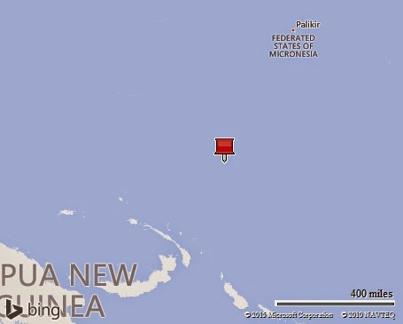
I do need to finish my opening comments regarding the connection to the United States. Where we went today was our first stop in the Federated States of Micronesia. Kapingamarangi Atoll is part of the Caroline Islands and at the very southern end of the island chain. Within the Caroline chain there are five main island groups, and four of those now comprise the Federated States of Micronesia. The fifth and westernmost island group became the country of Palau. All of the islands became a UN Trust Territory under US administration following World War II. Independence came in 1986, along with a Compact of Free Association with the US. This Association was amended and renewed in 2004, and under the terms of that agreement the United States will provide roughly $2.1 billion in grants to the FSM, which includes the creation of a Trust Fund to provide an income stream after the agreement expires.
Every day Lisa and I are blessed to see What a Wonderful World we live in and I never cease to be amazed at the many things I am still learning about our planet. I hope everyone is enjoying our travels.
Jim
PS I forgot to mention that last night we crossed the equator.


No comments:
Post a Comment