
Monday August 18, 2014
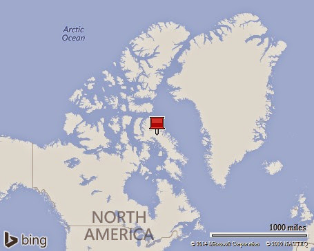
Our journey west across Baffin Bay finally brought us to Pond Inlet, Nunavut, Canada. If you are at all like me, you have probably never heard of “Pond Inlet,” nor do you have any idea as to what the term “Nunavut Canada” means!
Canada is somewhat like us having a parliamentary democracy and a federation of “Provinces” analogous to our States. They also still consider themselves part of a constitutional monarchy, Great Britain. In addition to their Provinces, they also have three “territories:” The Northwest Territories, The Yukon, and the most recent territory created in 1999, Nunavut. Our journey in the northern reaches of the Canadian Artic thus begins in the Territory of Nunavut.
Pond Inlet is considered one of Northern Canada’s “Jewels of the North.” It is home to around 1,600 people, mostly Inuit. It is a “Port of Entry,” and the economy is largely based on government employment. We came ashore in our Zodiacs to a “wet” landing on to a sandy beach. We were greeted by several local guides who proceeded to provide us with a walking tour of the community. Since it was a Sunday, it was quiet, but we did get to see the town library, and eventually ended our walk at the Community Center. Here locals gave us not only a warm welcome, but also gave some moving and extremely interesting performances of Inuit traditions. Having just left the coast of Greenland, and having visited several Inuit towns along the way, it was a surprise to see just how different the Canadian village was. Gone were the “cookie cutter” homes all colorfully painted in one of five colors, and gone too were the little harbors jammed with fishing boats since here fishing is not even part of their town economy. The people here were all very friendly and everyone to whom we spoke was conversant in English – although the signage in town is generally written in the local language which is completely unintelligible to me.
The scenery of this area is simply incredible, with snowcapped mountain ranges visible on every horizon. The beautiful bay still has several floating icebergs, and one interesting fact is that when we started our trip in Greenland we were shown an “ice chart” of this area that indicated that the surface of Pond Inlet was 90% or more ice covered. By the time we had arrived here however, the ice coverage has just about disappeared. So two things to note: most of the year the waters in this beautiful part of the world are frozen over and also when the surface ice starts to breakup, it can disappear quite quickly. That is why our crew has hope for our eventually journey through the North West Passage even though still at this time, the charts are showing significant ice along our intended route.
I assume that everyone realizes that we are travelling north of the Arctic Circle, and even though it is almost September, this area still has 24 hours of light each day. That situation of course reverses, and during the winter they have 24 hours of darkness. However, for now I can look out the window of our suite and during our passage last night could witness some truly breathtaking scenery. If I were a real adventurer, I would throw on my clothes and go outside to take pictures, but sleeping somehow sounds better to me right now.
During the night and into this morning, the ship moved north to North Devon Island. This island has the distinction of being the largest uninhabited island in the world. Our journey to this remote island was to allow us to visit the remains of an old Royal Canadian Mounted Police outpost located near Dundas Harbor. The photograph which was shown last night at the briefing suggested a wet landing onto a sandy beach which was right by the outpost. However, when our zodiac pulled ashore this morning it was onto a rocky beach and before me was a steep climb up a rock strewn hill dotted with bogs that were so mushy that they threatened to literally suck my boots from my feet. Lisa had decided she was not up for going this morning, and so she had stayed on the ship which turned out to be fortunate because there is no way she could have made the trek. I was dubious, but decided to gamely climb at least to the top of the hill to see the camp, and I suspected to get some great photographs. Well, I was correct about the photographs, but to my shock, the camp itself was over the hill and down to a beach on the other side. Apparently the picture I saw last night was correct; however no one mentioned that we could not land there because of the high surf. When I reached the top soaked in sweat and looked down on the remaining hike, I just about gave up – but out of pure stupidity I gamely went on. Without question, I was the slowest of the walkers, but eventually I did reach the base and made it back to the ship all without falling. I then promptly fell asleep for two hours.
Right now the ship is cruising to an area called “Crocker Bay.” Here we will visit the last glacier on our journey, Cunningham Glacier. The plan is for all of us to be given a zodiac tour up close to the glacier and then to return to the ship in time for dinner.
Let me share a couple of quick points. First, the ship has been without either cell phone service or internet for several days. Everyone was hoping that when we visited Pond Inlet yesterday that we would at least have cell phone coverage, but no one could connect. That seems strange since during our welcome it was mentioned that the town was proud of its new cell service, but none of us could connect to the network. We have a few passengers who are carrying their own satellite phones, and I understand that even they are having some difficulty in making calls. I know the ship itself is getting some communication over the iridium system, but for us for now; we are not connected, which this day and age feels strange.
Finally we have reached the area where the polar bears live. Starting today and from now on, before we are allowed off the ship a complete survey is made of our landing area to insure that it is free of bears. While we are off the ship, there are “bear guides” on our perimeter to sound any alerts should bears appear. If they do appear, then we must all return to the ship. We will probably see polar bears, but we will see them from the safety of the ship or from a Zodiac.
Lisa and I hope that everyone is well. I should remind you that when I write an e-mail at the same time I will post it on our web page where it will have a map and usually some pictures. You can reach that page by going to theglobe-trotters.com
Also if you just would like to see some pictures from the trip then you can jump directly to the by going to https://picasaweb.google.com/jstevens10
Jim


No comments:
Post a Comment